
Whenever I see the word “falls” in nature I feel drawn to see them and try as I might to capture their beauty in a photograph. So reviewing the map I started on Falls Trail.


Parking Tip: park at the John Read Middle school across the street from the entrance. Easy peasy.
Normally quite excited to run to the destination of the falls, I paused even upon the entrance to the trail and started to take pictures.
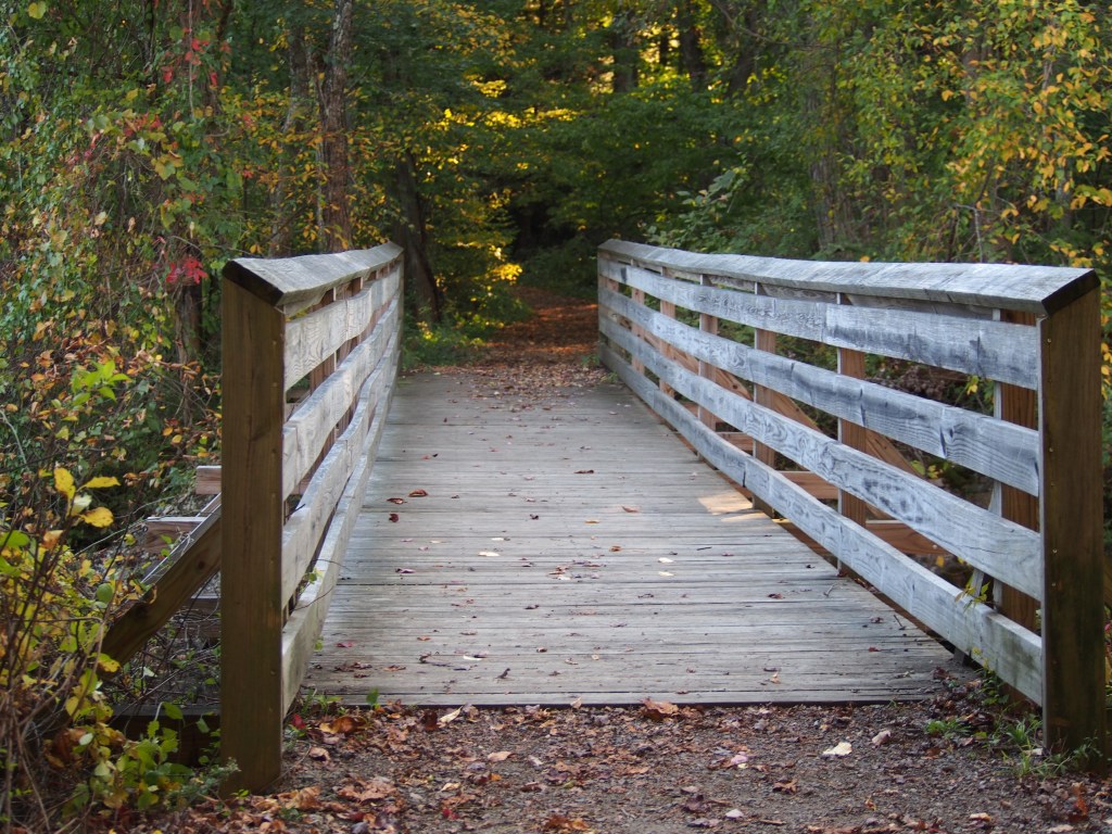
As you start on the trail you are soon upon a little footbridge. Oftentimes I quickly take a peek over the sides and walk on to my goal.
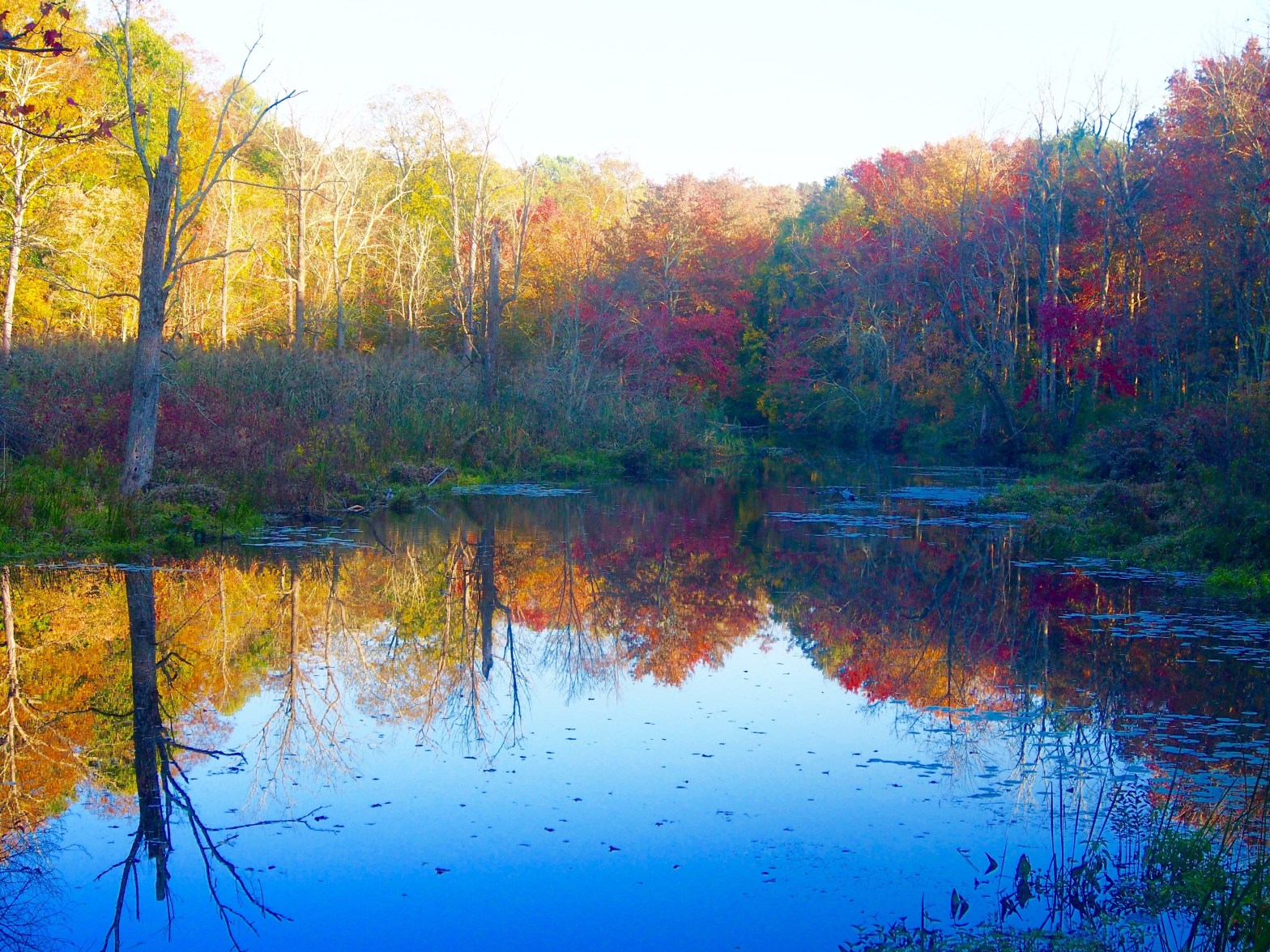
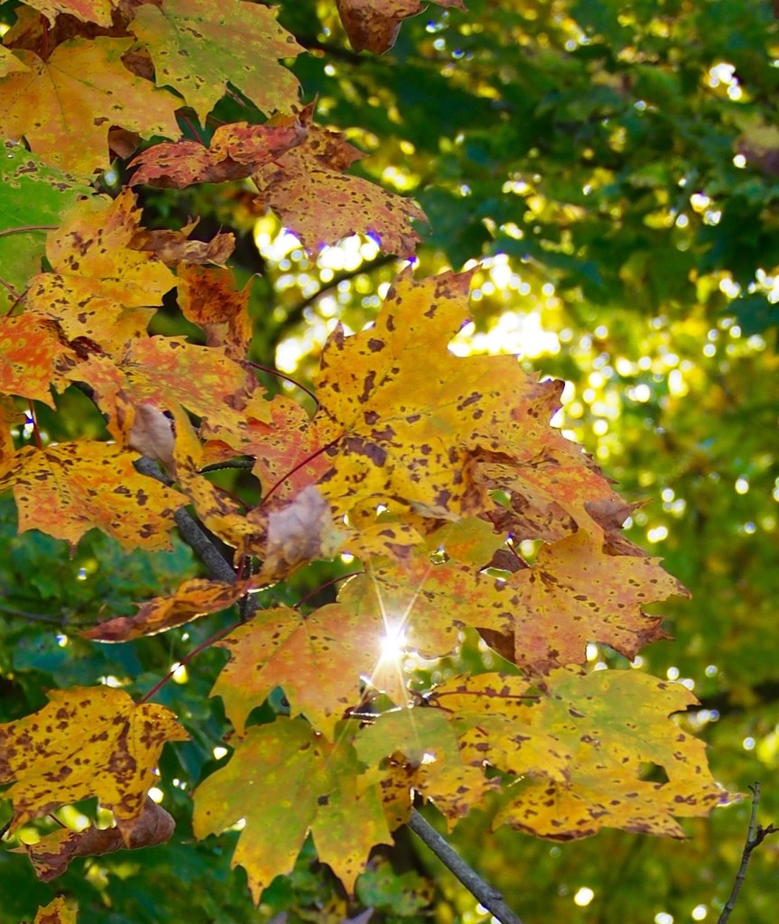
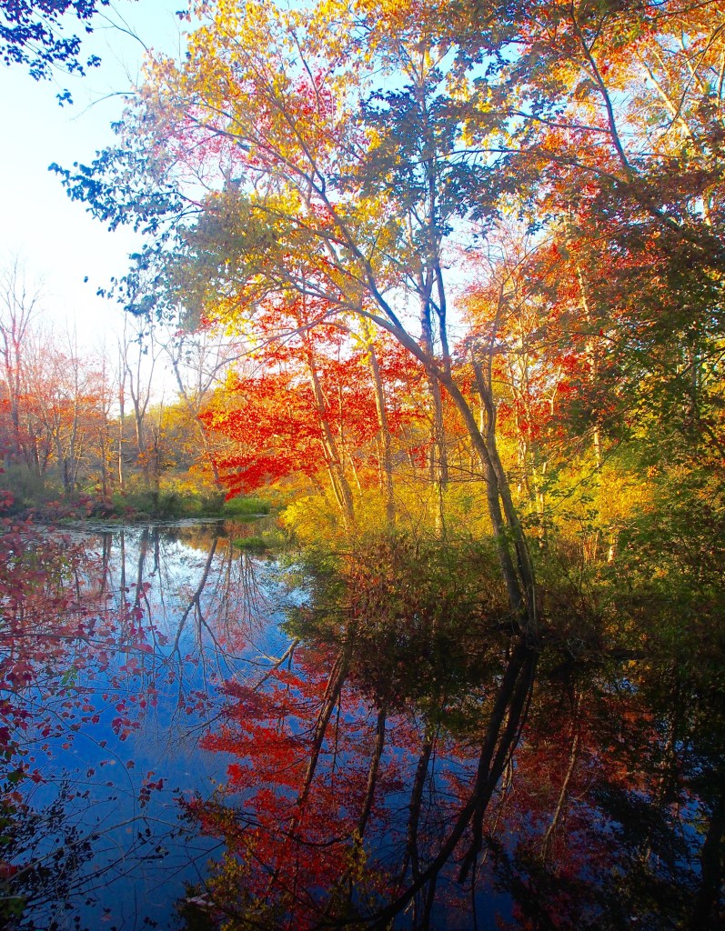
Had I not paused, I would have missed the reflection of transitioning trees in the water. I enjoy having the camera not because I’m so skilled at photography but it gives me increased focus to appreciate what I might see through the lens. I noticed the streaks of red and yellow as I sought to frame the picture in such a way as to pronounce the colors both in the sky and water.
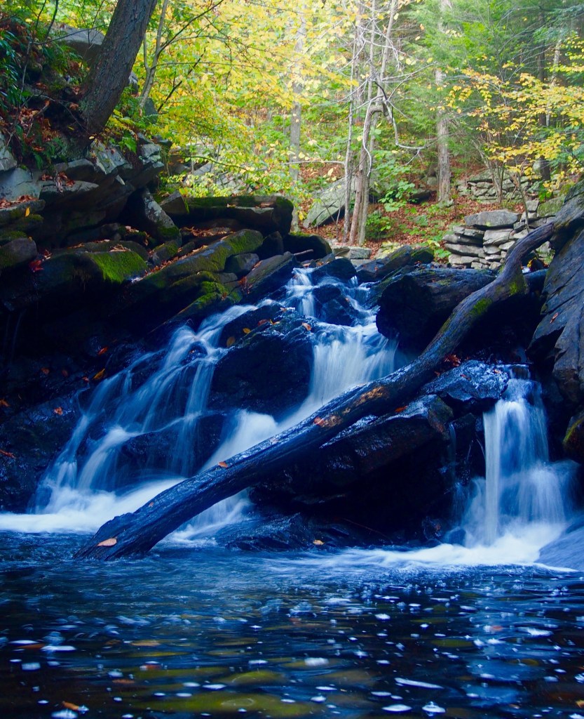
The trail I chose was short along the river but there were rock scrambles by the water to overcome. Consider this should you choose this hike trail. As I went in the Fall, the leaves and water also made it slippery.

But all of this forces you to take your time and take in the mystique of the forest.


Walking towards the falls you come upon what apparently used to be a local swimming hole. I could envision kids coming here in the heat of the summer to cool down. Fun to envision in my mind’s eye. Rocks divided the swimming hole from the rest of the water where there was a boulder on which to rest.


Fun then to finally come upon the waterfalls. There were a few areas with rambling waters across the rocks. The sun was starting to set so at first I was concerned to find my way back across the rambles. TIP: there’s a Road right by the falls! A little barrier and you get to the road! I was able to stay right until the sun set!

I will be back to try the other trails. I would love to see this area in the different seasons. I’m sure they vary in experience. Below is an excerpt from Redding Land trust on the different trails and experiences that I hope to try.
From Redding Land Trust Site
White blazes: Knapp Way, 1 mile; Hemlock, 0.2; Falls, 0.83 mile; Burn, 0.53Blue blazes: Old Field, 0.67; The Cutoff, 0.2; Oak, 0.4; Wall, 0.25; Hardwood, 1.3; Power line: 0.56Total all trails: 5.74
Walkers may turn left onto Old Field Trail and stroll beside the river. Look for a white oak, 12′ 10″ in circumference, and a shagbark hickory eight feet around (very large for the species). The soil on this floodplain is said to be 40 feet deep. In early May, marsh marigold, rue anemone and red trillium are abundant along the trail. Just off the trail, on private property, a “kettle” (glacier-made pond without inlet or outlet) may be observed.
Turning off lower Falls Trail onto Hemlock Trail, you are in fragrant evergreen woods with the music of a sparkling brook to accompany you. There are magnificent rock formations and cliffs on upper Falls Trail, which is perhaps best reached via Knapp Way and Oak Trail and then traversed from north to south. Falls Trail leads to Saugatuck Falls (a bit off trail to the east) and, below them, Falls Hole. Both are sights to see. In June, deep pink, shell pink and white laurel under the power line are worth a special trip.
For more difficult but also rewarding hiking, try the Burn and Hardwood Trails, beginning near the Diamond Hill entrance. The former traverses the scene of a forest fire in the mid-1970’s, offering an interesting study in the ecological recovery of a burned area. A steep ascent above a deep ravine leads to the Hardwood Trail, which passes through thick laurel stands and along the base of splendid cliffs, then descends over a rocky path to the river.
