I usually bring food with me on my jaunts. I prepare something easy at home and bring it along.
Sometimes, however, I decide to pick something up along the way. With so many options I have added food to the blogs to potentially make it easier for others.
For my trip to Gillette Castle I originally was going to stop at the Blue Oar but learned it was closed (likely a future blog about that restaurant by the water).
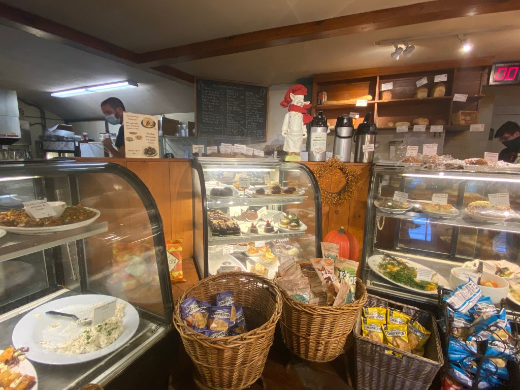
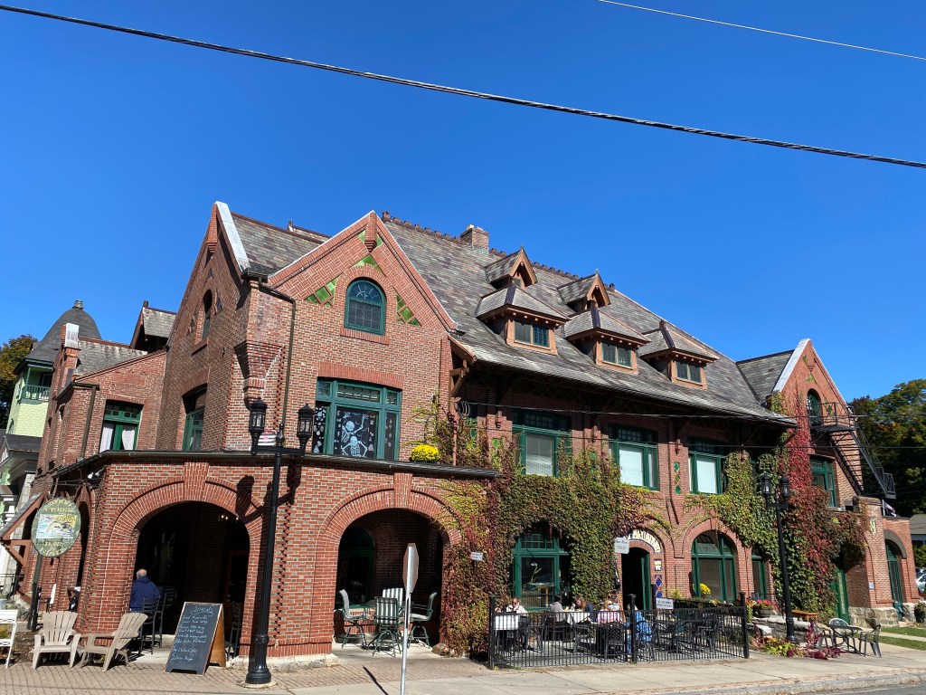
I drove by the Cooking Company and based on its curbside appeal and the name decided to take a look. I like when places have strict covid guidelines posted and they do. They also offer curbside pickup.
Their menu offered a list of fresh ingredients from which you can basically make any combination of wrap or salad. I enjoyed one of their chicken wraps and fresh broccoli salad with a hazelnut coffee. Small observation but I was surprised they didn’t offer brown sugar given their theme.
I found the staff to be respectful and patient and the clientele was as well! Everyone maintained social distancing and wore masks with rules around how many can be in the store at once.
I later learned they are both a good take out market as well as a bakery which makes sense given the incredible desserts I eyed. They also had a sign to mention any allergies and I always tip my hat to those that offer that up proactively. I find that type of signage puts customers at ease to raise any dietary restrictions when some may otherwise feel shy or awkward.
The Haddam location is very close to Gillette Castle at 1610 Saybrook Road, Haddam, CT 06438 right at an intersection. Should you choose to call ahead for curbside pickup the number is 860-345-8008. Below is also a link to their website.
I brought my lunch over to Gillette Castle (see blog on Gillette) and sat at one of their many picnic tables. The meal and environment was so delightful I often wonder why anyone would do anything else when given the chance for lunch.
Picnic at Gillette Castle
If you grab food from here let me know what you got and if you liked it! Might help me know what to get next time!
Update: As of January 2022, I learned this location is no longer.
The first time I went to this park it was on a whim.
Oftentimes I’m headed to one place and then seek to fit one more adventure in since I feel I have previously overlooked all Connecticut has to offer.
This was how I encountered Giuffrida park. I have since learned it’s a top choice for many as it has a short hike option with big rewards!
While there are several trails offered, I had read about Chauncey Peak and the overlook so that was my goal. I liked the idea of this hike as it is a 2.7 mile loop (as opposed to an out and back on the same route).
Chauncey Peak
From the lot facing the kiosk, I chose to go to the right to start the ascent up to the peak. You could choose to go left first which is starting on the easier part of the route and then the ascent. I liked the idea of getting the harder part of the hike done first. In other words I went counter clockwise around the lake in the map below. The ascent is along the right side of the lake.
Trail Map
I noticed there was a walking stick ready and waiting at the start of the trail and accepted that gift kindly as it definitely made the hike easier.
Be Present Gift of the Day
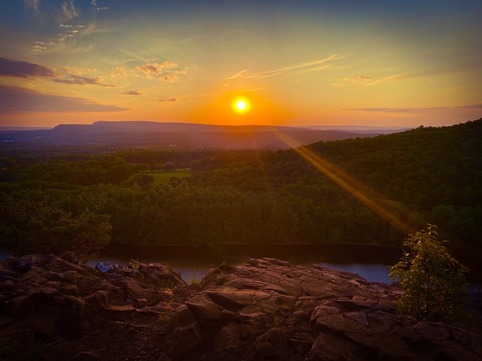
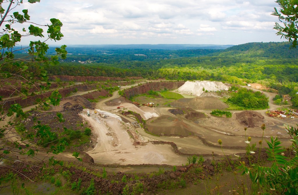
As you reach the top there is a stone working quarry on the right. At first I thought it was the overlook. Certainly impressive on its own but not what I had in my minds eye. I later learned the quarry owns Chauncey peak and has supported its continuing to be a public hiking option. I would suggest going before this has any risk of changing.
York Hill Trap Rock Quarry
I continued along the hike and ultimately reached the peak. The overlook displayed crescent lake below and the forest and mountains above it.
The rest of this blog and pictures is more of a story of this visit with my friend so I will share first a bit about the park itself.
Giuffrida Park was acquired by the town in 1965 and named for a local well known and loved physician, Dr. Francis Giuffrida. Chauncey peak rises to 688 feet and is a traprock mountain that’s part of the Metacomet ridge. Complete trails in this park distance approx. 24 miles.
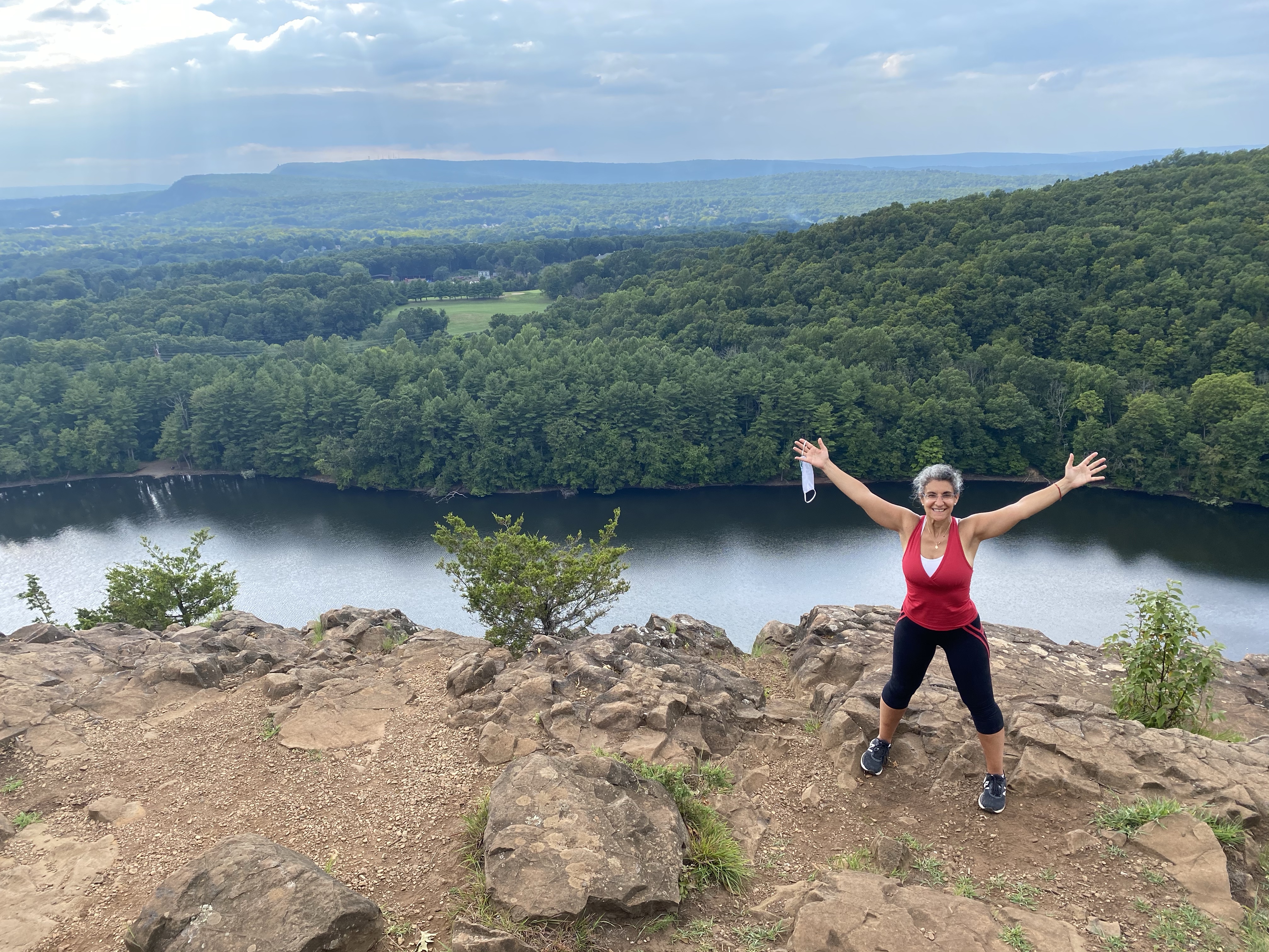
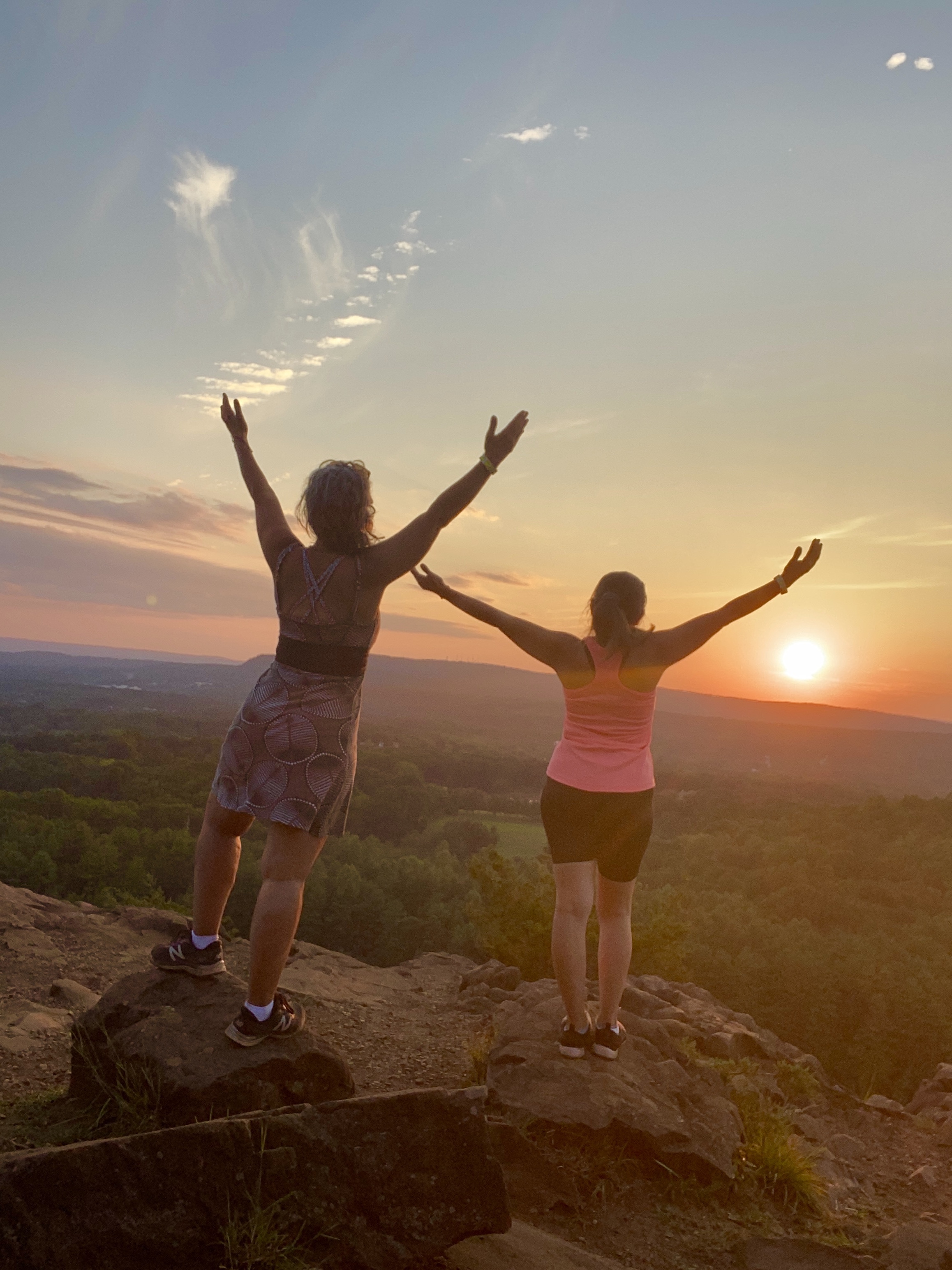
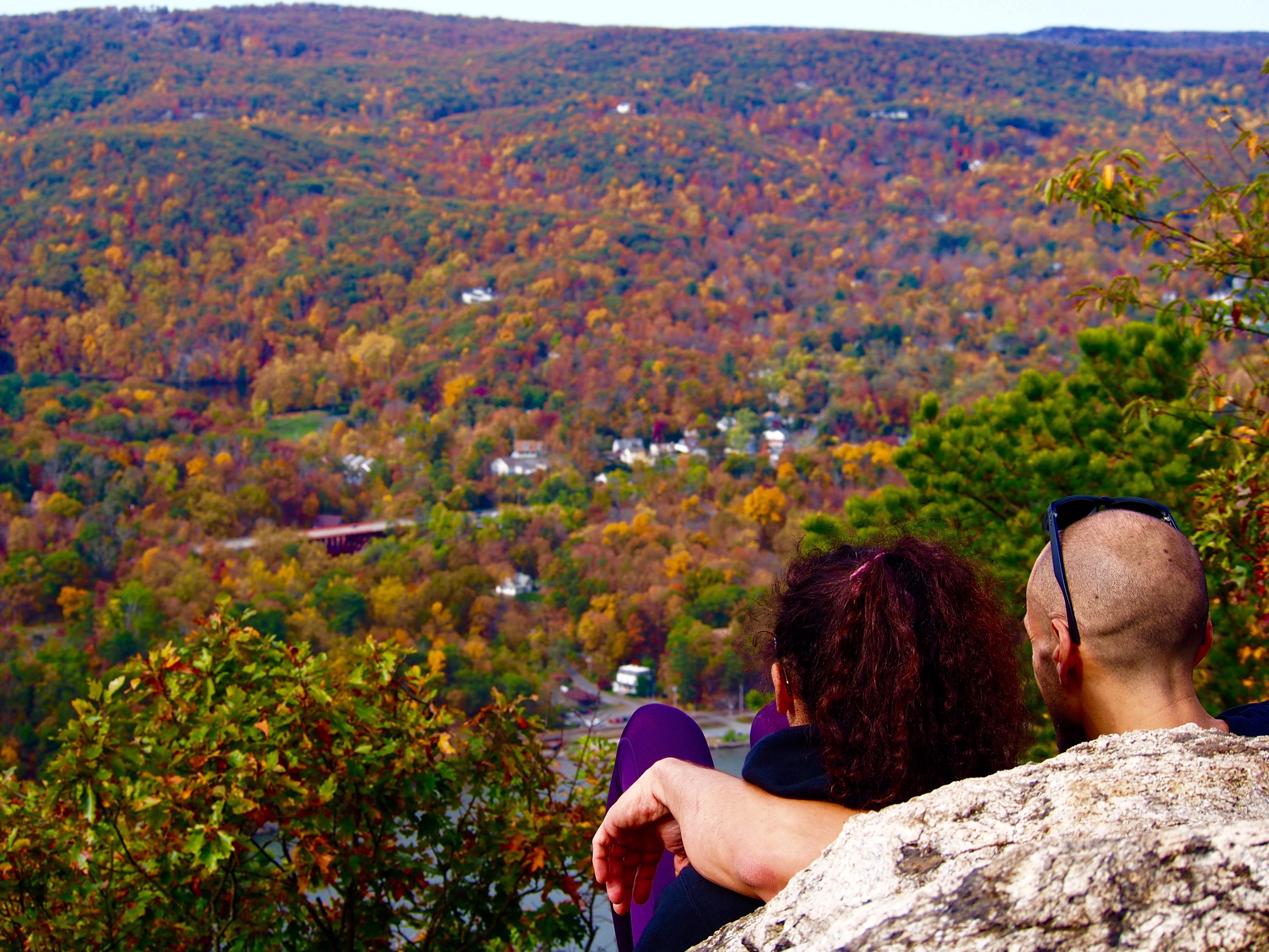
I had returned to this park with my friend and recognizing it was close to sunset we paused at the peak.
Blissful
Please recognize there is no barrier. Please stay clear of the edges and avoid selfies. Selfie accidents on hikes are on the rise.
As we started our descent we were mesmerized by the sunset and the views. One more picture . . . a few more steps . . . Another picture . . . a few more steps . . . and the sun continues to fall.
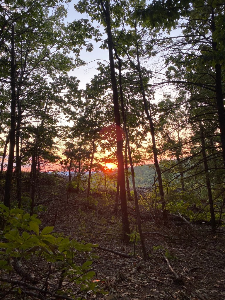
At this point we had to start going down as we didn’t have a flashlight. As we made our way further down the mountain we would get deeper into the woods and in turn it got much darker very quickly since minimal light could get through the trees.
And then it started. . . We heard the howling of coyotes.
At first we heard just one and then the others followed as if they were singing in a chorus. We suddenly had a jump in our step and started to joke with nervous laughter. I felt the need to put the video on in acceleration mode to record our decent partially as I need to keep myself busy and distracted.
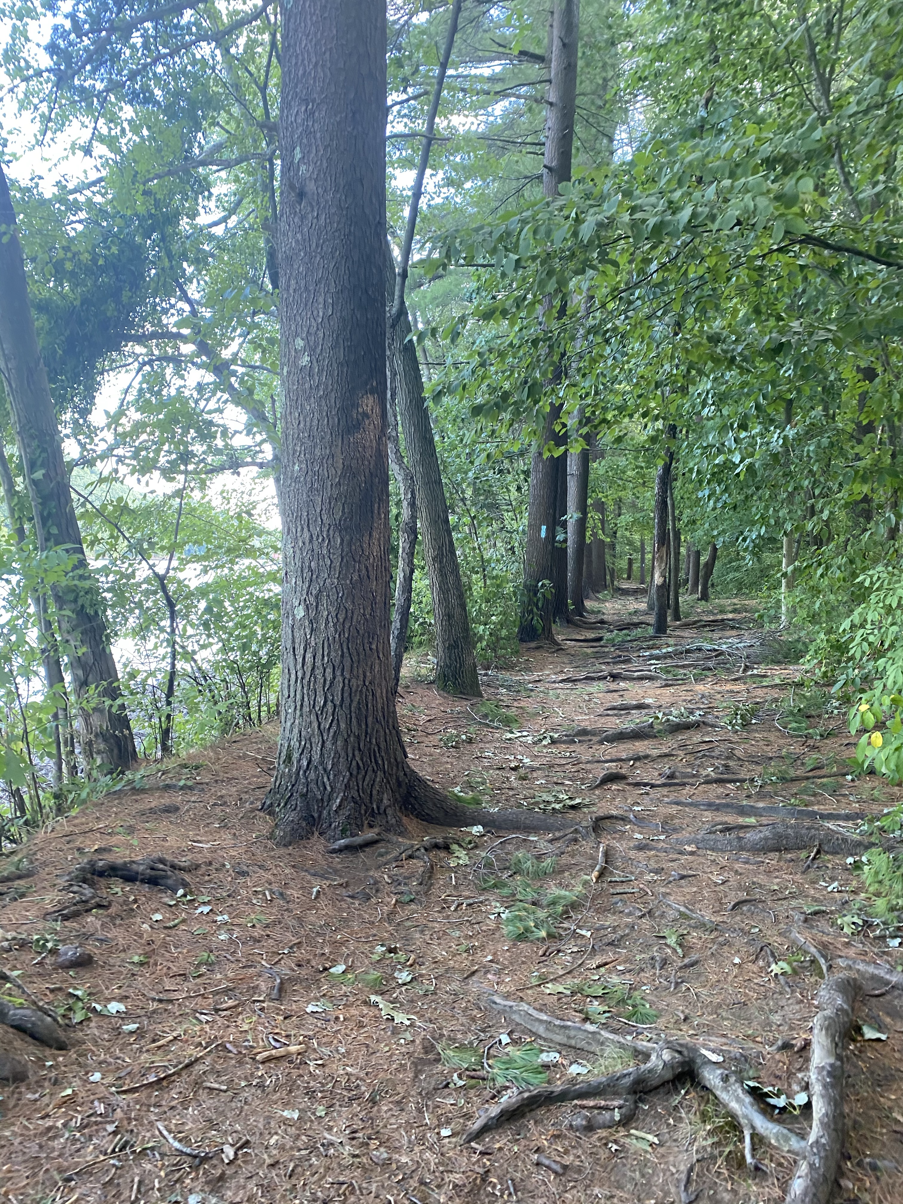
Fortunately choosing the steep part of the hike first at least gave us the ability to eventually get to the flat part of the trail around the lake. Please know that we were walking fast not jogging or running which is what you should do if you fear animals around. Below pictures were from a different day so you can see the ease of the trail on the return going counter clockwise.
We finally got down safely with moments when we truly were frightened by the howling. We encountered a park ranger at the base who confirmed our fears of bears, coyotes and snakes. His recommendation to us is to carry a flashlight and a noise maker should we choose to hike at sunset again as well as keeping hold of the stick to distract an animal if needed.
Back at the base!
This is an awesome and fulfilling hike in CT. Don’t let the coyotes story discourage you just learn from it and ensure to carry appropriate gear and know the rules of hiking.
In relation to this blog and all the places I go, I was asked, “where do you get the energy?”
I thought about how to answer that question succinctly as sometimes I wonder what pushes me to go out almost everyday and find something new to see. The answer is simple yet broad.
In short, I am motivated by overcoming perceived challenges by holding myself accountable to my own commitment to find beauty in my current surroundings.
In many ways I find my original expectations of life turned upside down. I spent many years professionally turning losses to profits and inefficiencies to productivity. Basically laser focused on looking for a problem and fixing it; makes sense it’s what I do. I then realized that approach isn’t always sound or healthy on the more personal level.
Sometimes, I just needed to hear and see things differently . . . reframe my lens . . . pause and pivot and suddenly I see beyond the obvious challenge.
Pequonnock River, Trumbull, CT
I am grateful for the epiphany. I see so much more than I ever saw before in my immediate surroundings.
Did this park just open?
Do swans fly?
Does the moon come out every night?
Why does a beaver make a dam?
I started the blog as it is such a fulfilling way to capture the memories both for myself and for others. Personally my father died of dementia and pictures and videos was how we promoted his presence with us even briefly.
More profoundly I hope it also conveys ways to see beyond the problems and challenges of life even briefly.
The blog in and of itself motivates me to go out and “virtually socialize” during such an unsettled time. If you are reading this you motivate me to continue.
I can’t change the world from being upside down. I can’t stop people from judging me or others, I can’t stop illness or job loss, I can’t stop prejudice or political unrest.
While I was raised to learn from history and “never forget” and ensure to lead to effectuate change, I am no longer obsessed with trying to only fix the darkness. There’s a balance to be struck.
I now allow myself the time to walk through the shadows and find the glimmer that waits to be seen. I had always rushed passed it and was focused on the problem that needed to be fixed.
I take on each new adventure as a challenge to find those opportunities to see what I hadn’t seen before and as I do, suddenly the light overcomes the shadows. Even if just briefly.
That light is my energy.
But it isn’t easy to always find the motivation. I put this blog together in hopes to make it a bit easier for others.
You are my motivation.
Sign up to receive new postings on outdoor adventures, tips and moments of inspiration!
The hike referred to as Anthony’s Nose is a 2.6 mile out and back hike in Hudson Highlands State Park Preserve, Beacon, NY. It is considered a short but steep hike up a natural stone outdoor staircase. There are several trails to get to the overlook but I have chosen each time to enter near the Bear Mountain Bridge on 9D. This is a great hike for those that wish to start to try rock scrambles and practice endurance with a big reward.
My research from “scenes from a trail”, has taught me that “the 910 ft. peak has been known as Anthony’s Nose since at least 1697, when the name appears on a grant patent. Pierre Van Cortlandt, who owned this mountain, said it was named for a pre-Revolutionary War sea captain, Anthony Hogan. This captain was reputed to have a Cyrano de Bergerac type nose.”
Parking is along the shoulder of Route 9D but can get very crowded on the weekend. Also be cautious walking up 9D to get to the kiosk as with all the cars parking there is no shoulder.
Just past the Putnam County sign on the right side of the road, you’ll see a kiosk and white blazes marking the start of the hike. Turn right to head uphill here, following the white blazes of the Appalachian Trail.
The hike indeed starts steep; you’ll gain 700 feet of elevation in the first quarter mile, I would recommend wearing hiking boots and grabbing a stick for added balance right from the start.
I took the white trail (which is the steep section) to the blue trail (which is a more gradual and rewarding incline) to the overlook. The trail is well marked.
While considered a short hike, given it is like walking up a stair case for the first half you can feel the distance.
As you head up the mountain and see others on their return way down, I found they often would share encouraging words to continue to see the prize. I have enjoyed many hikes but I would say that part of the fun was receiving this motivation. It happened so often I started to ask the question proactively as I saw people coming down – “so they say its worth this climb, yes?” I always got a resounding YES! Keep going, you can do it, it’s so worth it!
Once approaching the top you almost can’t tell until you turn the corner at the top and then (BAM!) there it is! Picture yourself in these scenes and then make it happen!
Looking down Anthony’s Nose
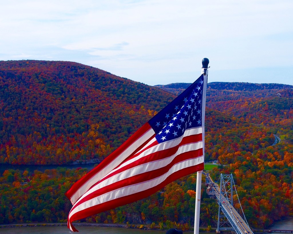
You are rewarded with panoramic views of the Hudson River, the Bear Mountain Bridge, and Bear Mountain-Harriman State Park. There are also memorials for the FDNY and NYPD.
Be Present Gift of the Day
I usually grab a picnic lunch for the top. The hike is steep enough for you to savor the reward with a relaxing bite.
I had trouble finding the trail markers on the way down and since read that many others have as well. Also, I find the way down is most important to have that stick or walking poles to help brace yourself down some steep slopes.
While much of the focus for the blog is naturally about the overlook, I enjoy looking around as I hike for something unique in order to maintain my attempts at remaining “present.” I then came upon a tree that to me was shaped like an animal! I later researched further and I think Wild Boar. What do you think?
Wild Boar!
If this hike is not enough for you, I would recommend combining going to Manitoga which is a few miles down the road on 9D for a day’s adventure for the tour of the home of Russell Wright (see separate blog on Manitoga) as well as walking across the Bear Mountain bridge to take in those views!
Collaboration from a friend
My friend Kim Wilson joined me on this adventure in October 2020 and his impression is the first collaborative input I received for my blog.
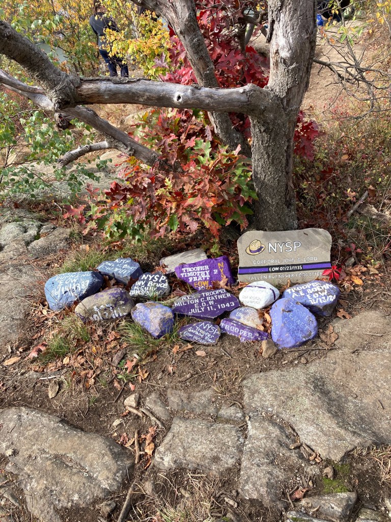
“Reaching the summit, there were quite a few people there. I stopped at the fallen state police memorial that someone had installed and paid my respects to all these fine men that gave their lives protecting our lives and defending our freedoms.”
NYPD Memorial
I like this for so many reasons. More than likely it was young folks who unselfishly took the time to display something that is powerful and beautiful.
My inspirational friend and collaborator, Kim Wilson
His comment to me which I think also best describes this hike was “this wasn’t a hike, this was mountain climbing!”
Sign up to receive new postings on outdoor adventures, tips and moments of inspiration!
I have visited Gillette Castle three times and it’s been a unique experience each time. But the last visit on a misty day in the Fall was by far the best. The blog is on the grounds as I have not yet toured the house.
The original castle was commissioned and designed by William Gillette, a stage actor who played Sherlock Holmes. While I never had the opportunity to tour the castle nor even the visitor center, the grounds itself make the day.
I have never been here when the house was available for touring but learned the following from my google search about the interior. . .
“A Connecticut native and typical pragmatic Yankee, Gillette designed the entire edifice himself, including the 47 doors, each of which has a unique wooden puzzle lock that he also devised. The castle also has all sorts of unique and quirky features, such as a disappearing bar (used extensively during Prohibition) and a set of mirrors that let the voyeuristic Gillette see down into the main room of the castle from his own bedroom (so he could see when guests arrived and could make the proper “grand entrance”).”
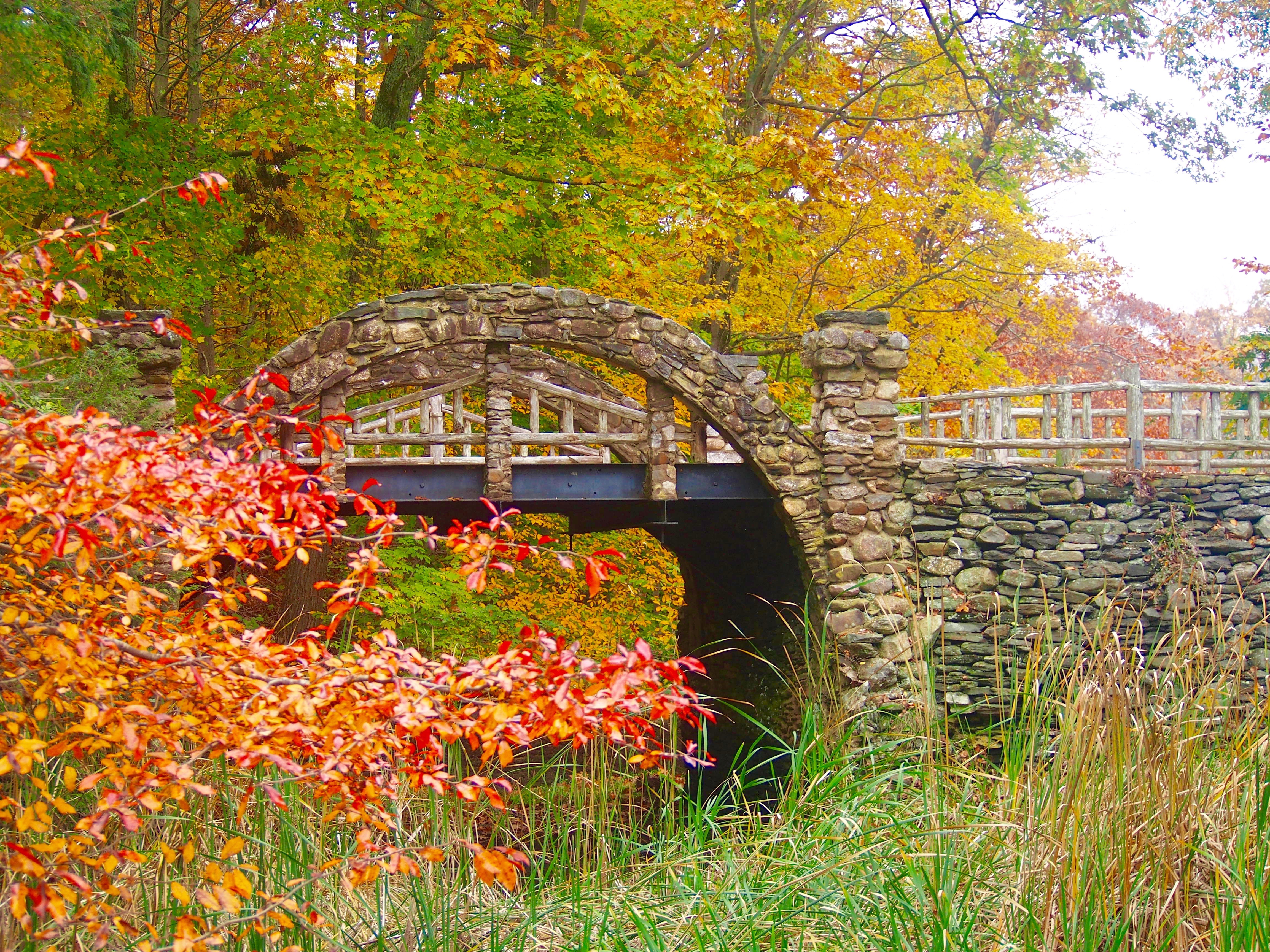
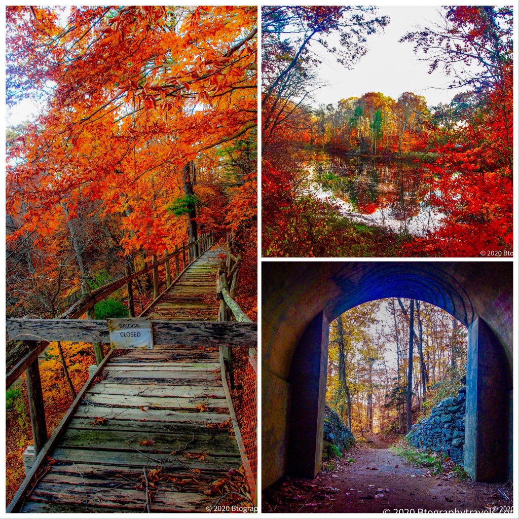
There are several maintained trails with different destinations of interest. The most memorable for many is the 3 miles of former train track used originally to transport his guests on a miniature train (the Seven Sisters or 7S RR). I have shared below a link about the railroad from only in your state and later an actual vintage video of a ride with Gilette!
As for my visit, I followed the train trail on its now walking bridges made of stone and wood which coupled with the color of the falling leaves made for a picture perfect day.
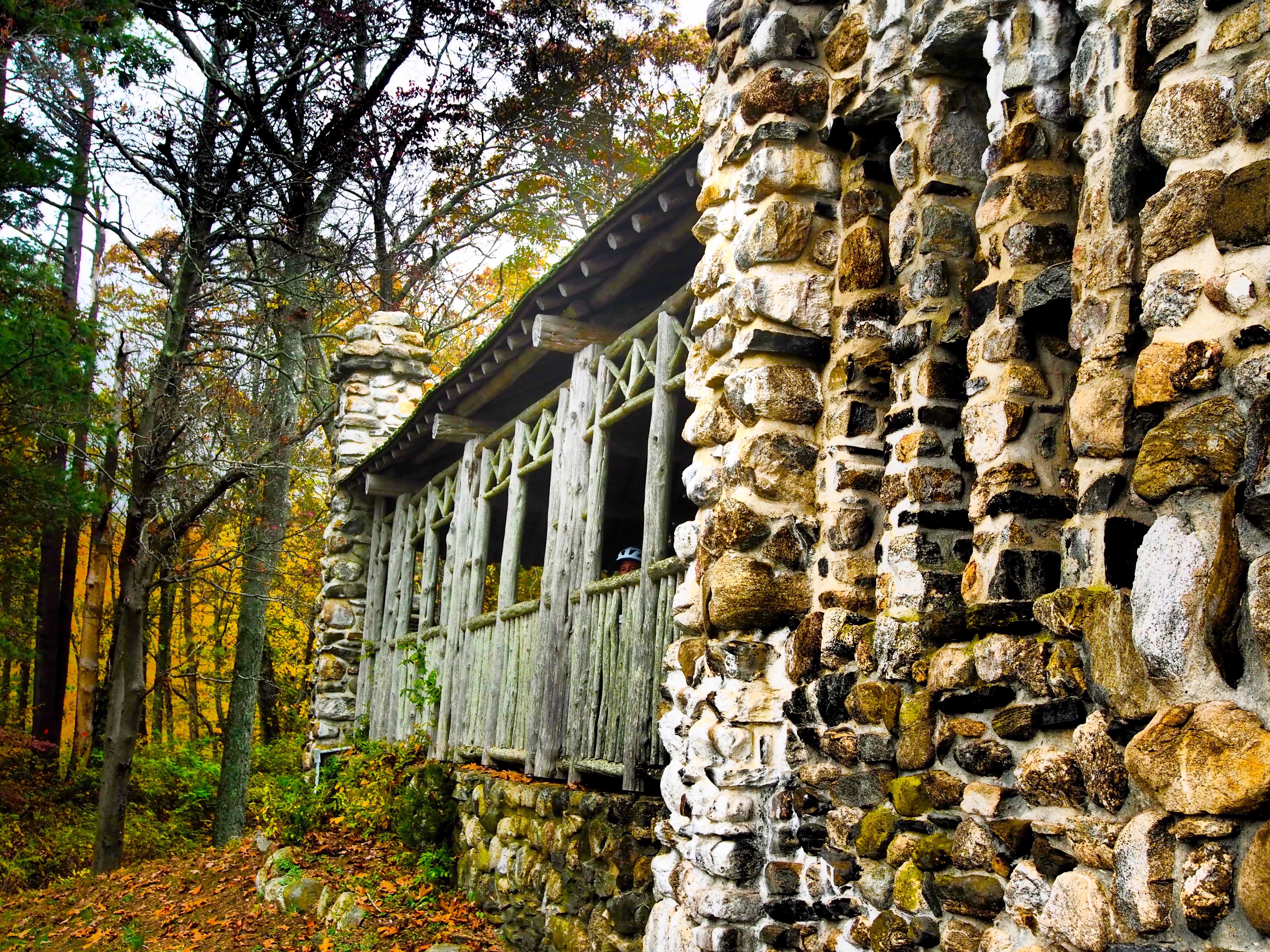
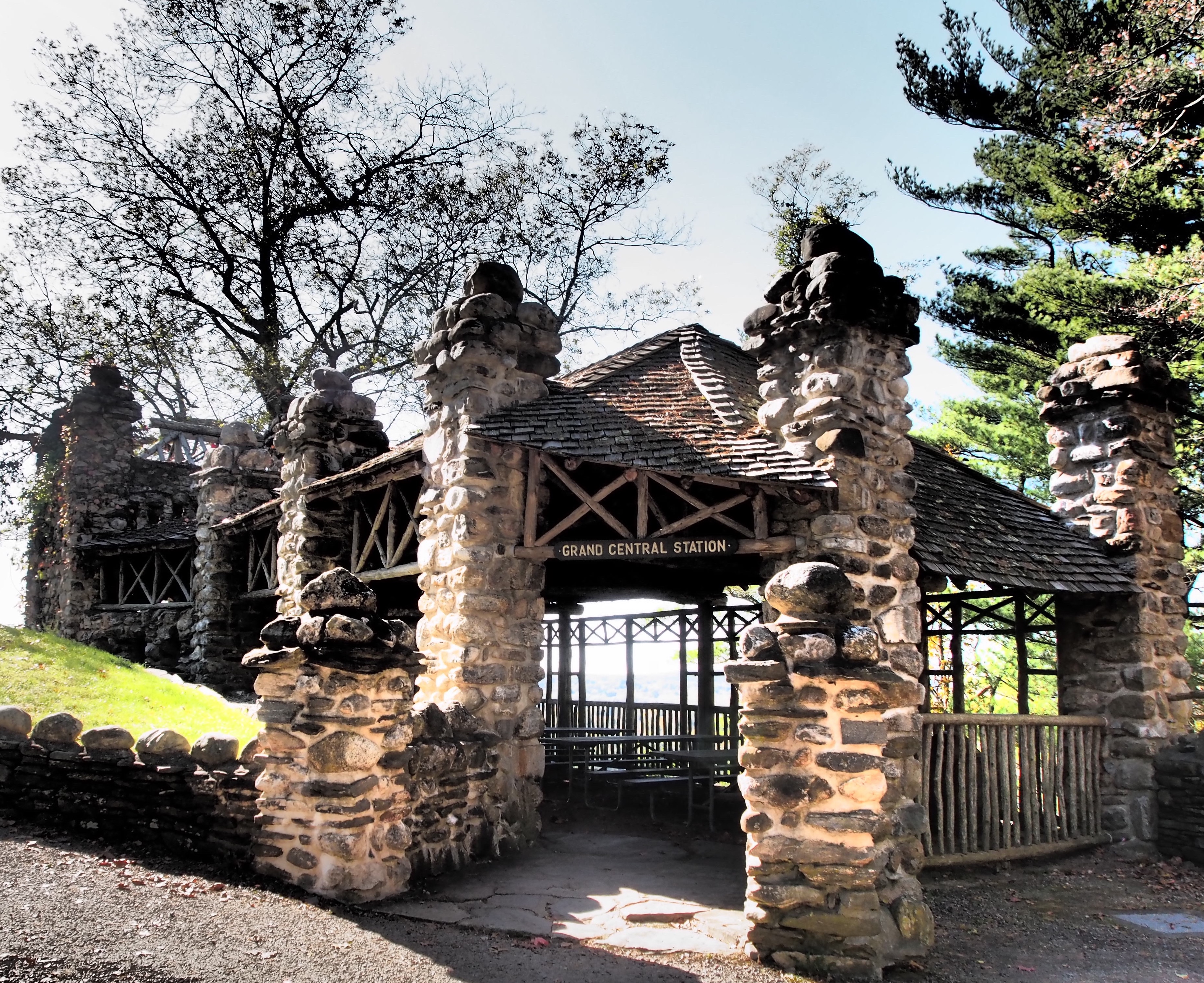
He even created his own “Grand Central Station” for his guests overlooking the Connecticut River which offers a view of the car ferry between Haddam and Chester. This is where he also proudly displayed his love of cats.
Fun fact: Apparently Charlie Chaplin and Albert Einstein rode on the former miniature train! Below is a YouTube link to a DEEP vintage video of Gillette and an actual ride on the train
Grand Central Terminal (ROLA)
A walk to the train tunnel is worth the adventure as you can almost sense being on the rail as a guest of William Gillette with the awesome settings he created.
As I walked to the Aunt Polly area as noted on the map, a flurry of leaves showered the trail. It was such a beautiful New England fall moment, I took a short video to capture the leaves blowing around the trail
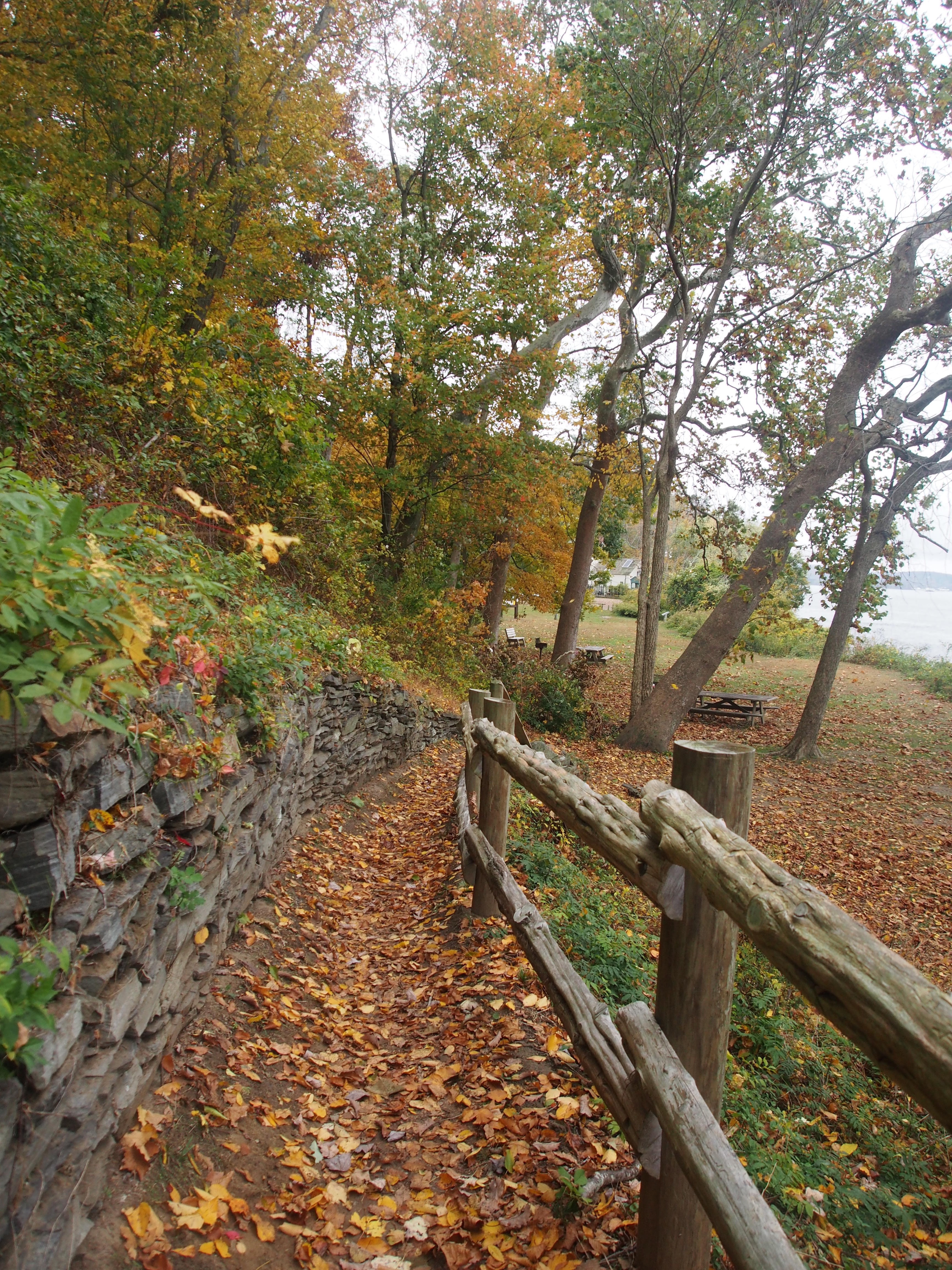
Down by the shore at the base of the castle is the area called Aunt Polly. The Hartford Courant wrote that “the boat, which burned in 1932, has been hidden in plain sight down the hill from Gillette Castle, a state park. The wreck has been battered by waves and wakes from heavy boat traffic on the Connecticut River. In the winter and spring, ice loosens ship beams like a giant thumb. Friends of the site want something done to protect it from the ravages of the splash zone in which it rests, partially submerged in the sand.”
Aunt Polly Area
Couple the day with a picnic from the Cooking Company or grab a bite at the Wrasslin Cats and reflect on William Gillette’s passion living with 17 cats. Also add a ride on the Chester-Hadlyme ferry (seasonal) to walk the lovely town across the river. Related blogs on each! There’s even more to see and blog about in this area.
Apparently, William Gillette expressed the desire in his will that it would never come into the possession of “a blithering sap-head who has no conception of where he is or with what surrounded.”
When I woke on this day it was foggy with a bit of a drizzle. At one point that may have discouraged me from going on an outdoor adventure. I’ve learned that provides an opportunity for a different experience and one I’m so glad I didn’t miss. I am happy I made that decision.
Be Present Gift of the Day (and my Mary Poppins impression)
I did ultimately return as I heard it was a pretty sunset spot. I did enjoy the colored glows in the sky after the sun went down beyond the mountain.
Below is the trail map for your convenience. Now go! 🙂
Sign up to receive new postings on outdoor adventures, tips and moments of inspiration!
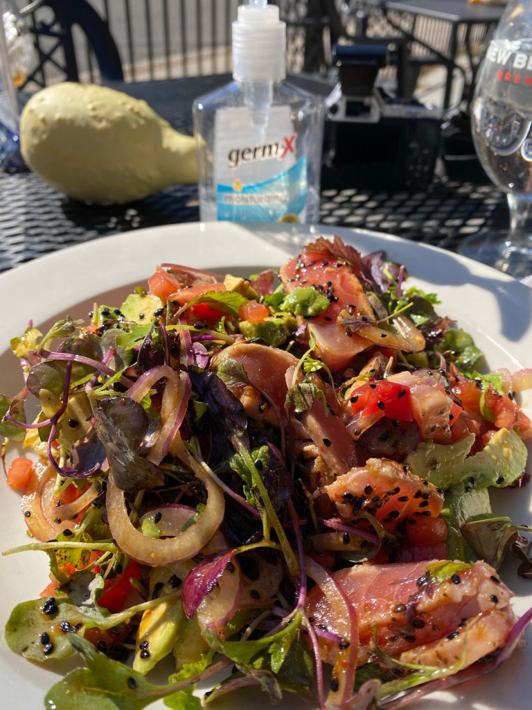
About a mile from Haystack Mountain and a bit longer from Campbell falls, in the small town of Norfolk was this excellent restaurant. I enjoyed an ahi tuna salad which was delicious. There is outdoor seating and they followed all the covid guidelines.
There were also other food options as well as a unique local craft shop.
Ahi Tuna Salad
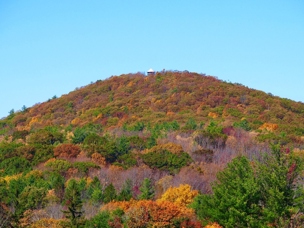
From this corner of the town you can also see the tower on the top of Haystack Mountain …that is as long as you don’t eat and run and choose to pause and take the time to see.
I found this trail when walking around at lunch when I first started working in Trumbull, CT in 2016. As a born and bread NYC gal I had not discovered all CT had to offer until I had already lived here for over 20 years.
Soon thereafter I rediscovered my love of biking and this is one of the first trails I travelled. The full trail is from Bridgeport to Newtown but is divided into segments with needs to go into the roads on occasion.
I often start this trail on or about Twin Brooks park in Trumbull off of Brock Street. Note you can not park here without a resident sticker all year round so I often park nearby and bike through. It’s a beautiful picturesque park with ponds, bridges, hiking trails and wildflowers. Here’s a peek of the park but it deserves its own write up at another time. It is a multi seasonal venue.
Twin Brooks Park, Spring, May 2019
In order to connect to the next section of the Pequannock trail you can bike through the park into a small residential neighborhood ultimately to Tait Road.
There is a trail head with trail parking at Tait Road and White Plains Road. It is across from a newly built (as of Fall 2020) CVS and Starbucks. The trail is paved in areas or lightly stone dusted.
Trail Head
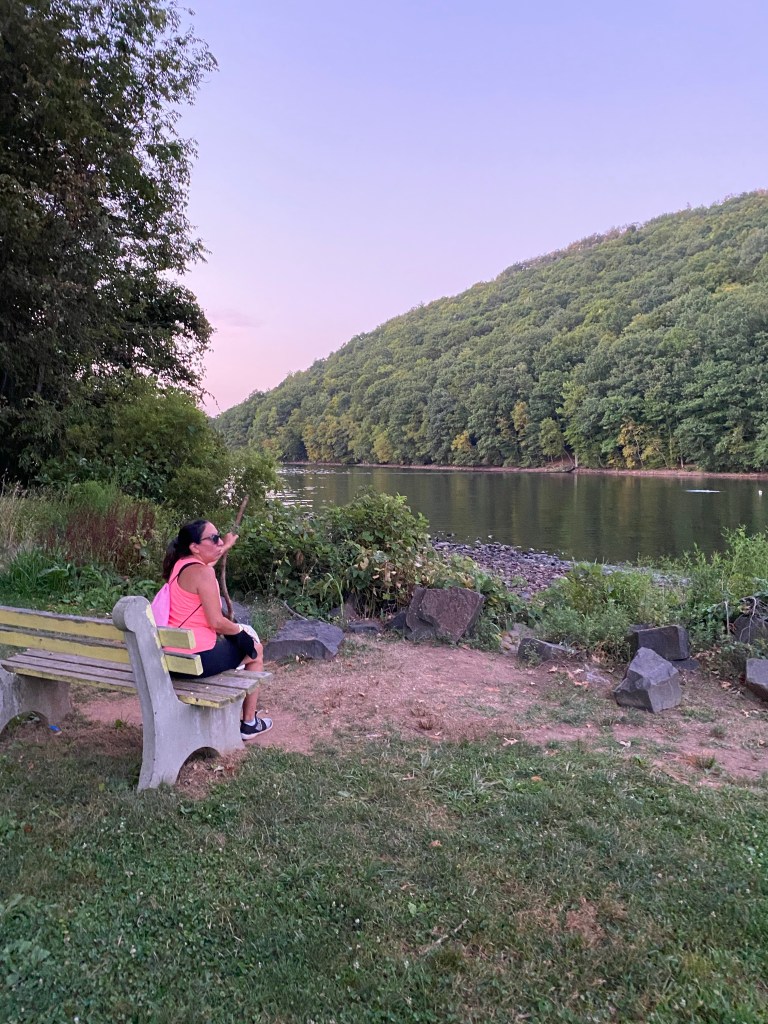
There are various segments of the Housatonic Railway trail. This blog is about the Pequonnock Valley Greenway which follows the namesake river for about 3 miles – a lovely and manageable walk or flat bike ride.
The trail travels along the river which I had previously known but had overlooked until this ride the opportunities to walk down to the water. Pay attention to where this is permitted versus private property areas.
There is generally a wooden picket fence along the trail from which you can see the river below. If you ride too quickly you might otherwise overlook the occasional opening beckoning you to hike to the water.
On this abbreviated afternoon workday ride I almost rode by to get to the end of this segment of the greenway. Fortunately I’ve trained myself to know better.
I lost my sense of time in my attempt to capture the calm of the colors, the scent of the trees, the sound and trickling of the water as it babbled over the rocks.
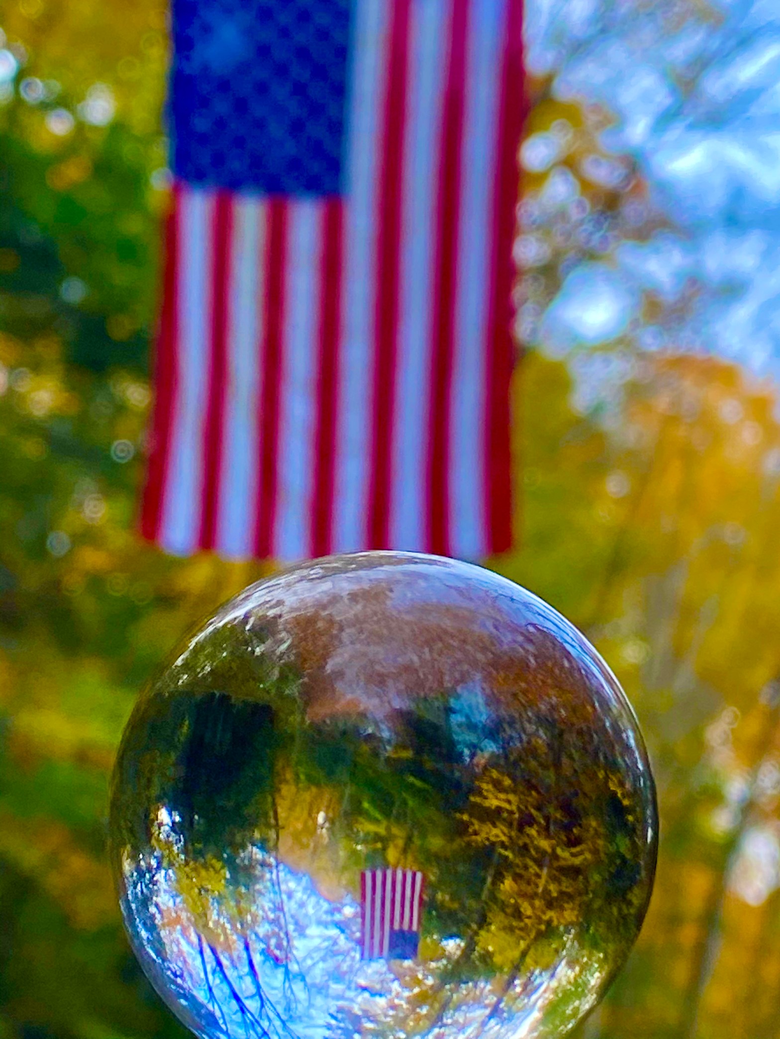
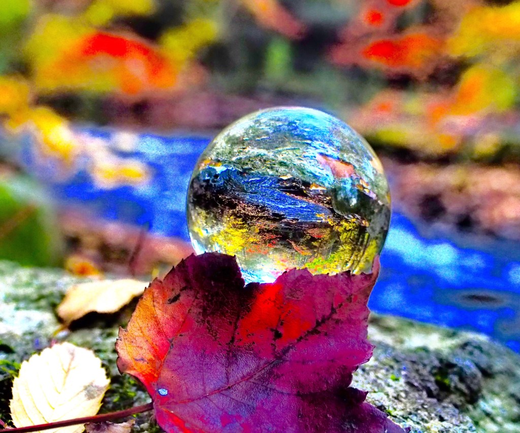
On this day I had also received a package of a crystal orb with which to try some photographing techniques. I learned of ways to capture the colors and their reflections in the sun setting stream of light both within the orb and in the distance. The glow behind the red leaf set on top of the green moss on the rock added an element of mystery.
Be Present Gift of the Day
The time was short but the memories everlasting and yet there is so much more rail trail to discover as the Pequonnock River Trail segments together total 13.6 miles.
In reviewing the trail map for this blog, I also see that there are several points of interests noted. I sincerely can’t wait for the next adventure on this trail to pause and pivot down to the water in the next segment, Parlor Rock, and seek out the various features recommended on the map! Huge lesson learned for me is to locate these maps ahead of time so as not to miss out on additional opportunities to locate these natural gifts and be present.
I found this link to details of how to get to each of the segments of the trail as well as a trail map with the points of interest.
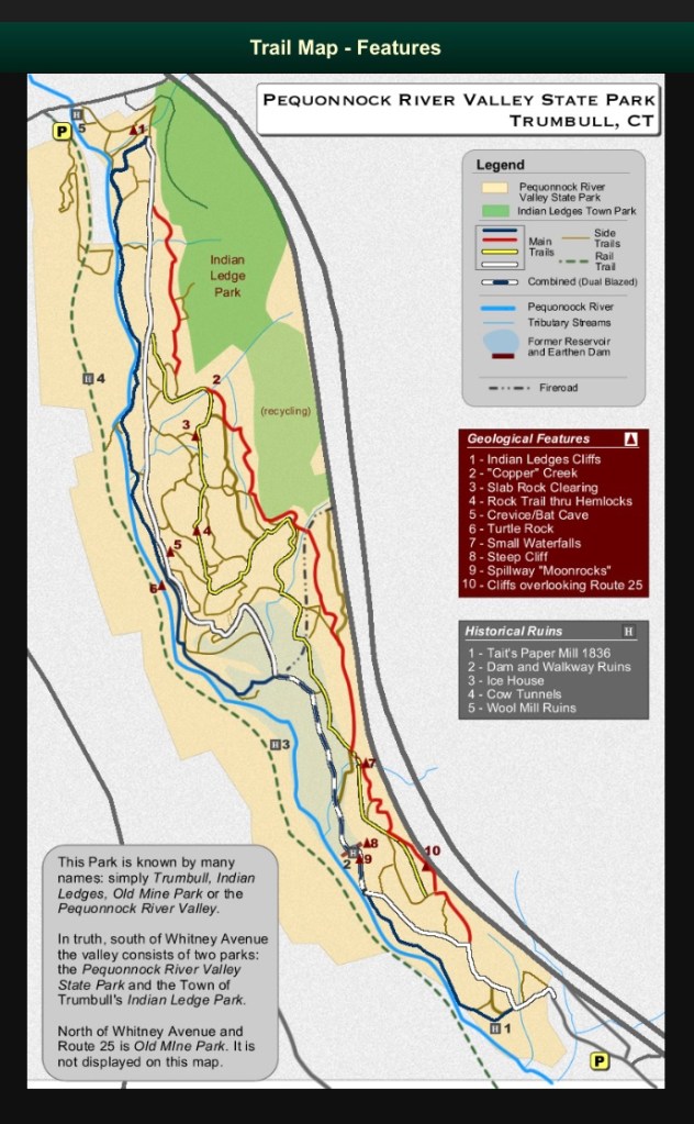
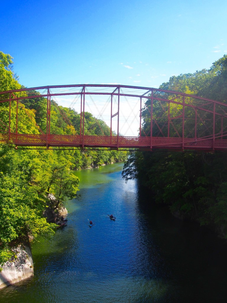
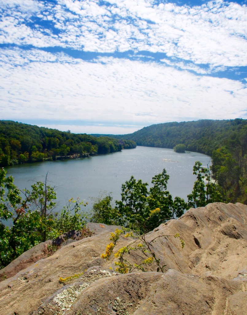
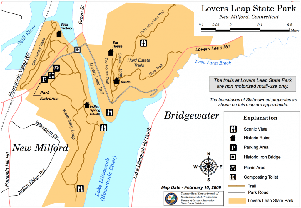
What’s not to like about this park. Short or long hikes, beautiful overlooks, kayaking, biking, wildlife and an awesome bridge with love locks and folklore. Not to mention it’s name, Lover’s Leap.
From the Connecticut state website they share, the “ trails through the park will lead the walker through centuries of land-use history. Heading northeast from the parking lot the trail utilizes the 1895 Berlin Iron Bridge, one of five remaining in Connecticut, to cross the Housatonic River. Across the bridge the Lovers Leap Trail heads southeast 1,200 feet to the rock formation that gives the park its name. From here, tradition has it, that the Pootatuck Indian Chief Waramaug’s daughter, Princess Lillinonah, and her lover plunged to their deaths. The Chief himself died in 1735.”
1895 Berlin Iron Bridge
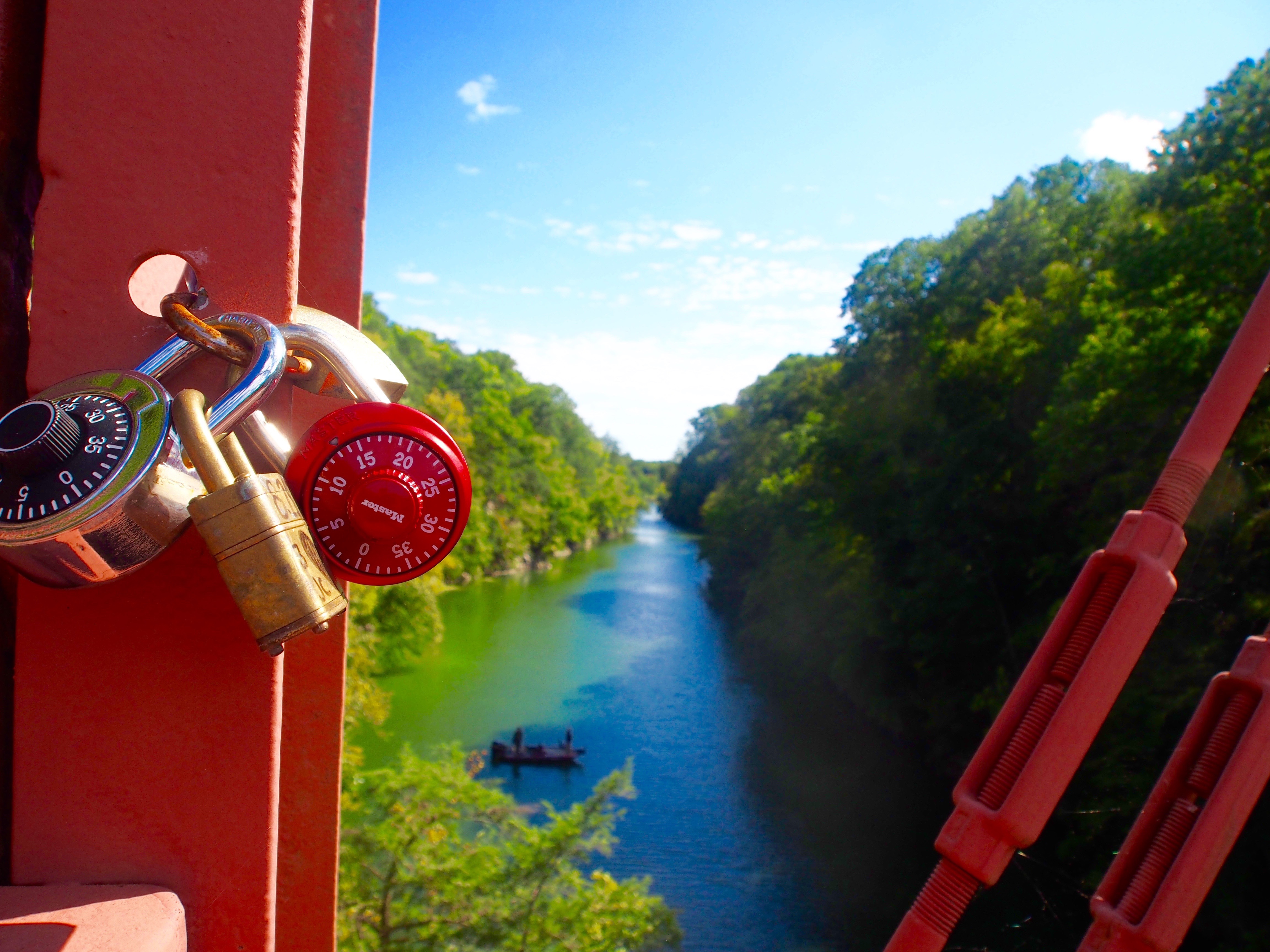
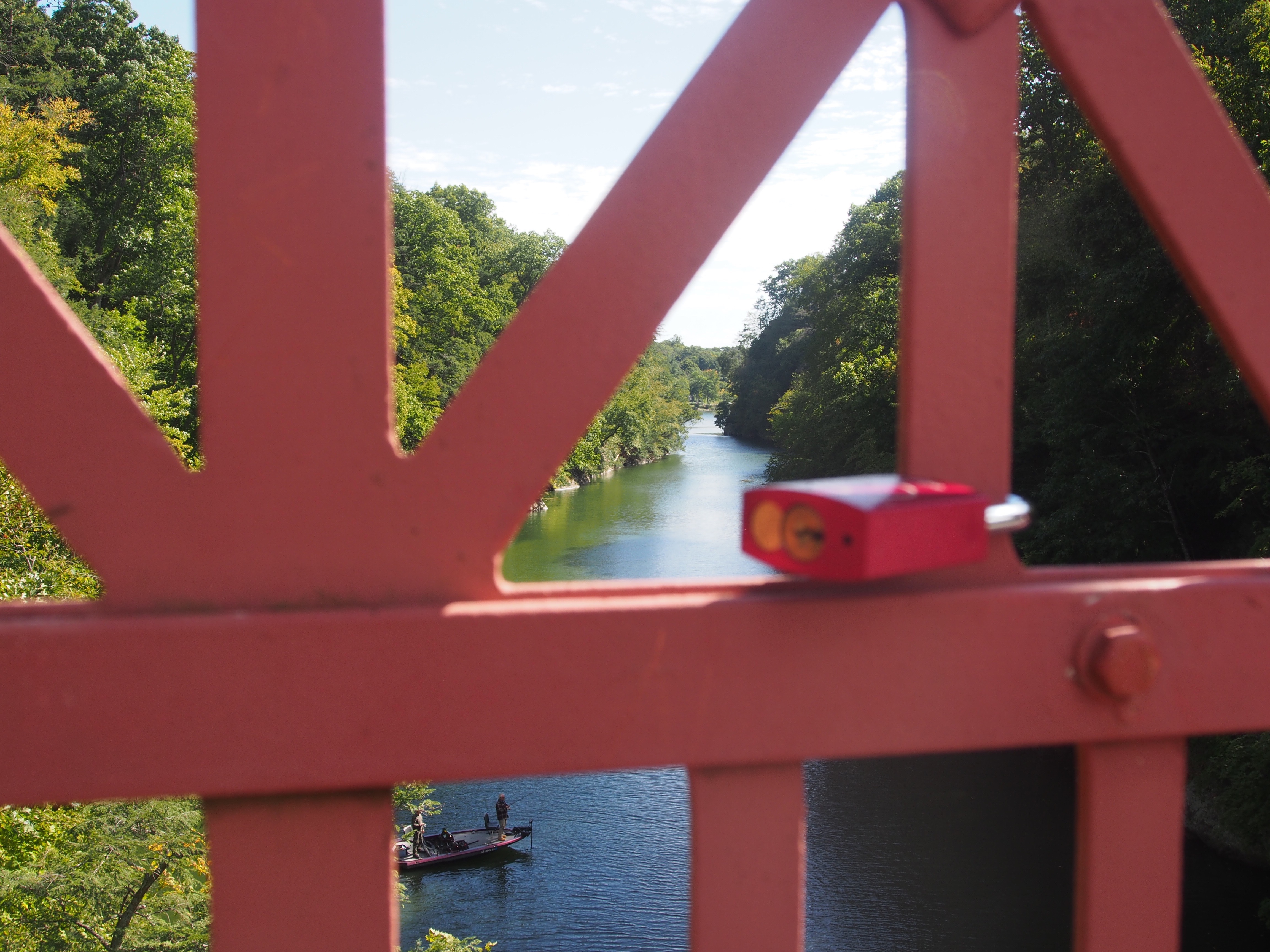
The hike begins from the lot crossing this bridge. Pause a moment and you’ll see hundreds of locks on the bridge representing the unity of lovers forever locked together.
Lover Locks
After the bridge turn right and not very far on the right is the overlook. Please note there are no barriers so be cautious.
Overlook
My understanding is that there are several trails from which you can pick. I have only hiked the short overlook trail as I otherwise have opted for kayaking the river.
Sign up to receive new postings on outdoor adventures, tips and moments of inspiration!
Coupling with a trip to Hidden Valley Preserve or Steep Rock Preserve, a great place to stop for lunch or dinner is GW Tavern.
Situated on the Shepaug River, the tavern is quite popular based on the queue that appeared 1/2 hour before opening. They have a lovely outdoor deck with tiered porch options for seating. I found it reasonably priced especially when you add in the environment.
The staff was friendly, the food out timely and they followed all covid guidelines with both an indoor or outdoor distanced options.
The grounds include a gazebo, lovely trees and a stone path down to the river. By the river is a dedication to a relative of a staff member. It reflects to me something special about this place and it’s staff.
I enjoyed the homemade salmon burger with dill cream served on a brioche bun and it was delicious.
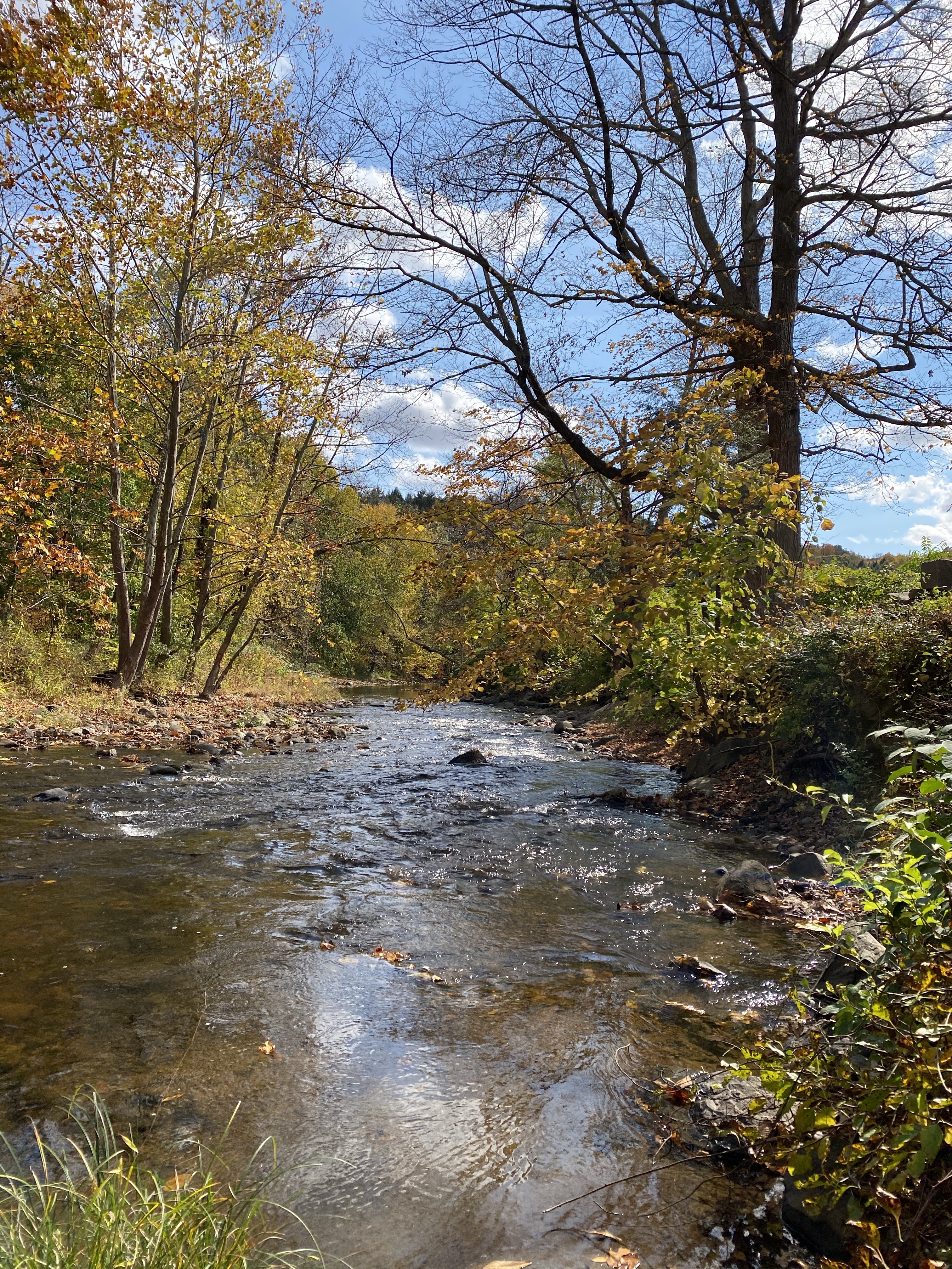
In the NW corner of Connecticut on the border of Massachusetts is the town of Norfolk. I was so pleased to find so many adventures, vistas, waterfalls and good food in one small town.
True it was a bit of a drive but it made for a wonderful day trip when done with a tour of the Fall foliage going up Route 8 and Route 44.
OLYMPUS DIGITAL CAMERA
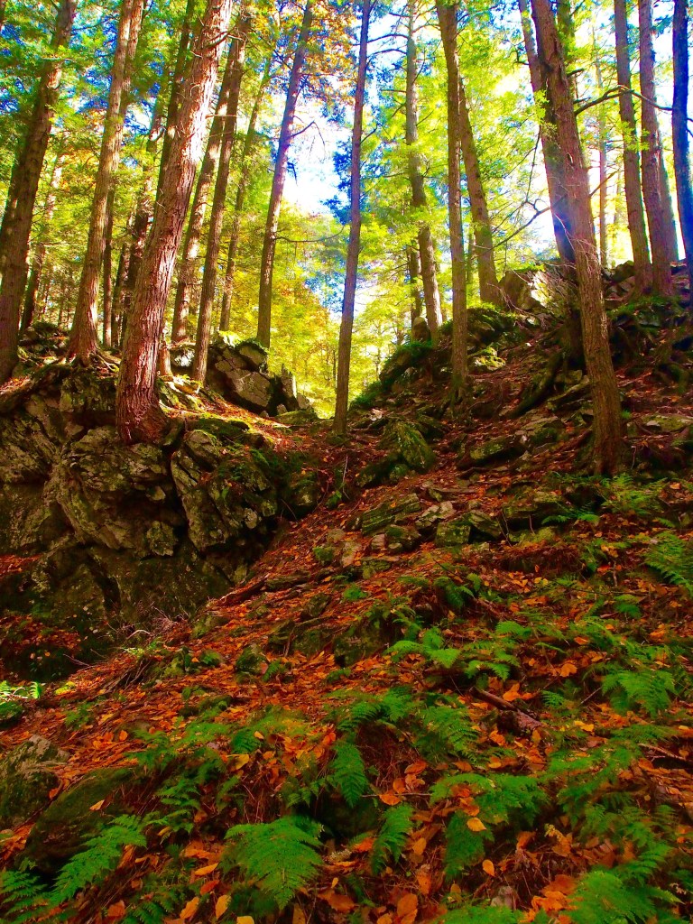
My favorite time to hike forests is the last couple of hours of sunlight. While it forces a deadline I love the shadows and streams of light.
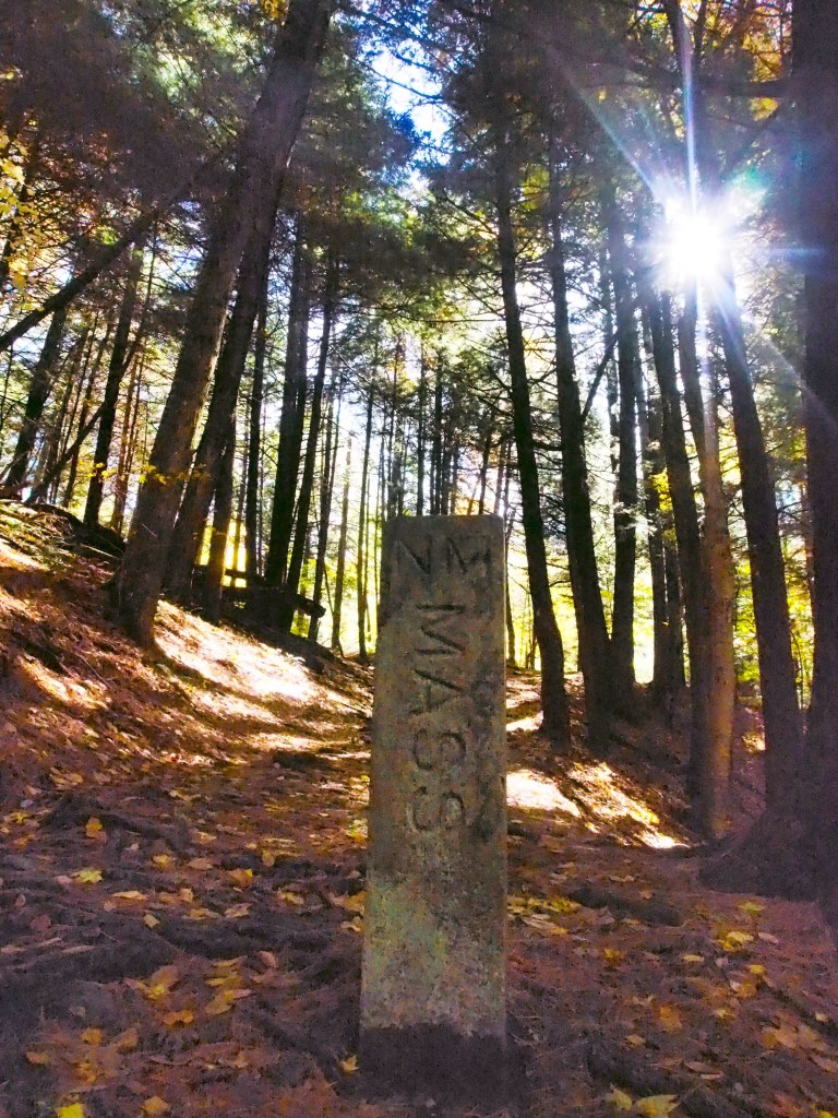
The fun part of taking the hike from the CT side is that shortly you come upon a stone border marker between CT and Mass! Photo op!
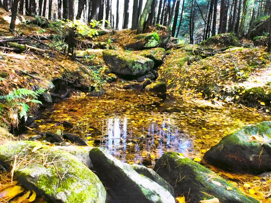
The moment I heard the flow of water I went off trail and slipped down the bank towards the babbling brook and for some reason was entranced by a pool filled with pine needles and leaves with light reflecting the trees in its center. I just sat for a while appreciating all the forest had to offer.
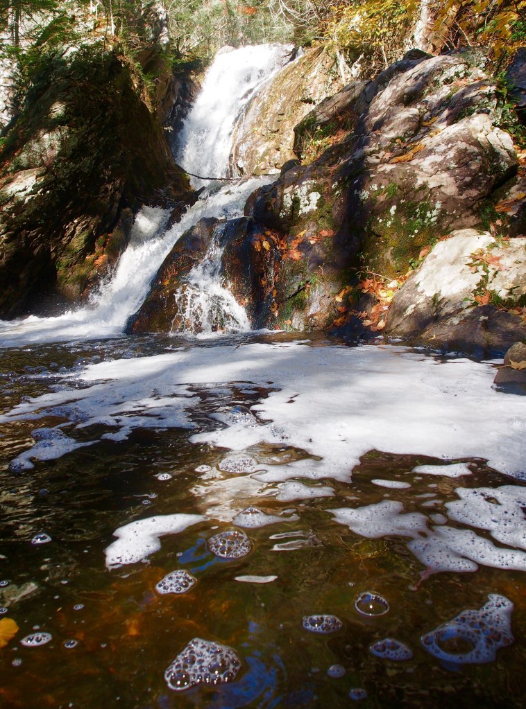
I soon came upon the falls and I was pleased to see its height and its stature at 50 feet high with multi levels as I had never heard of these falls. It was very exciting.
Of course the photo I took doesn’t adequately reflect its height as it’s two stories so I added another with me in it to better show the size of the top tier (I’m hiding behind the dead tree)
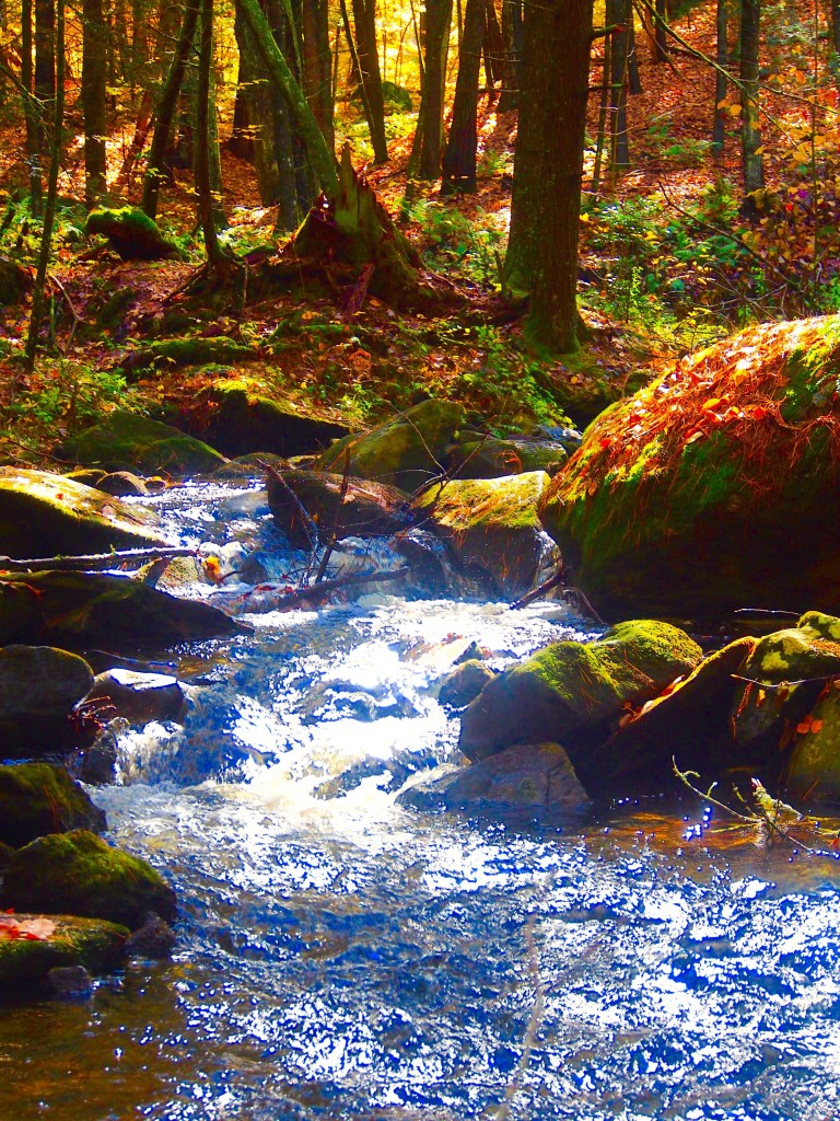
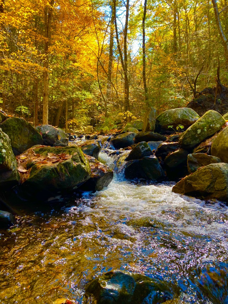
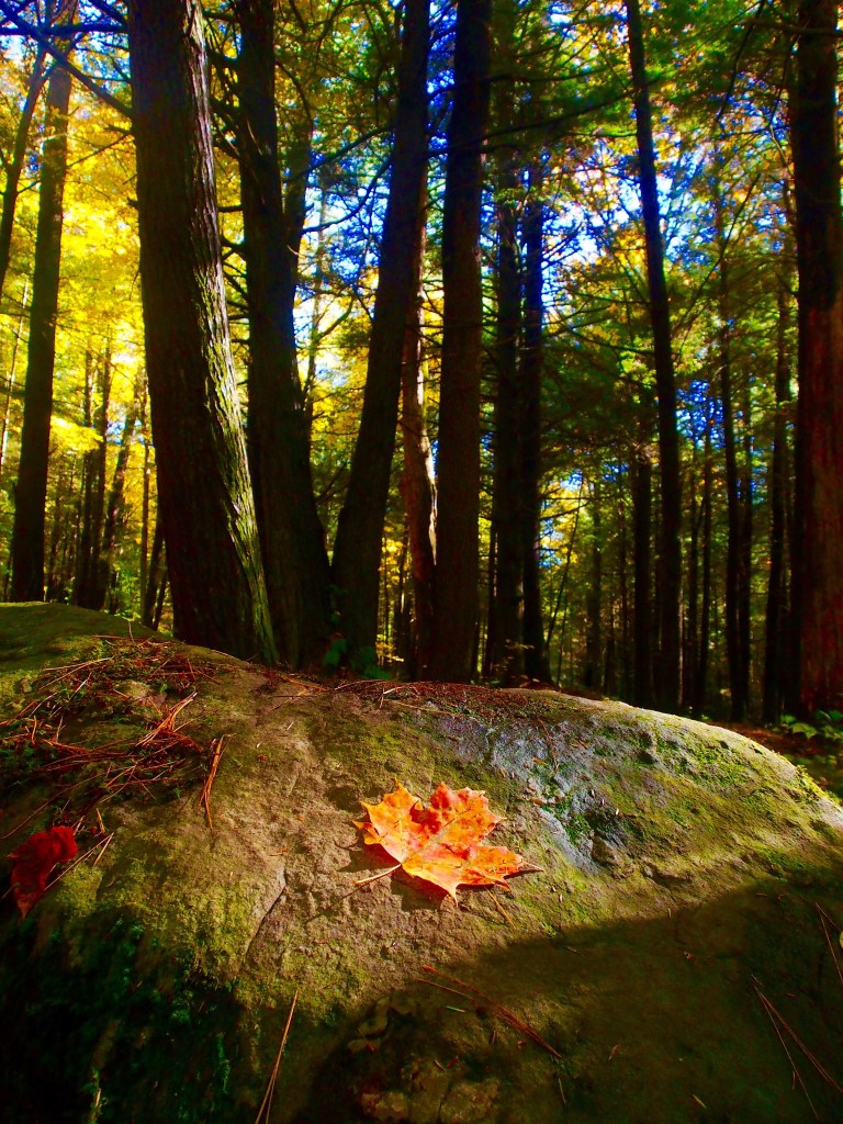
In addition to the falls the water then meanders through the forest creating different mini enclaves and adventures. The suns shadows, the moss on the rocks and the colorful leaves added to the mystique.
I definitely recommend wearing waterproof hiking boots so you feel comfortable walking anywhere in and around all the brooks.
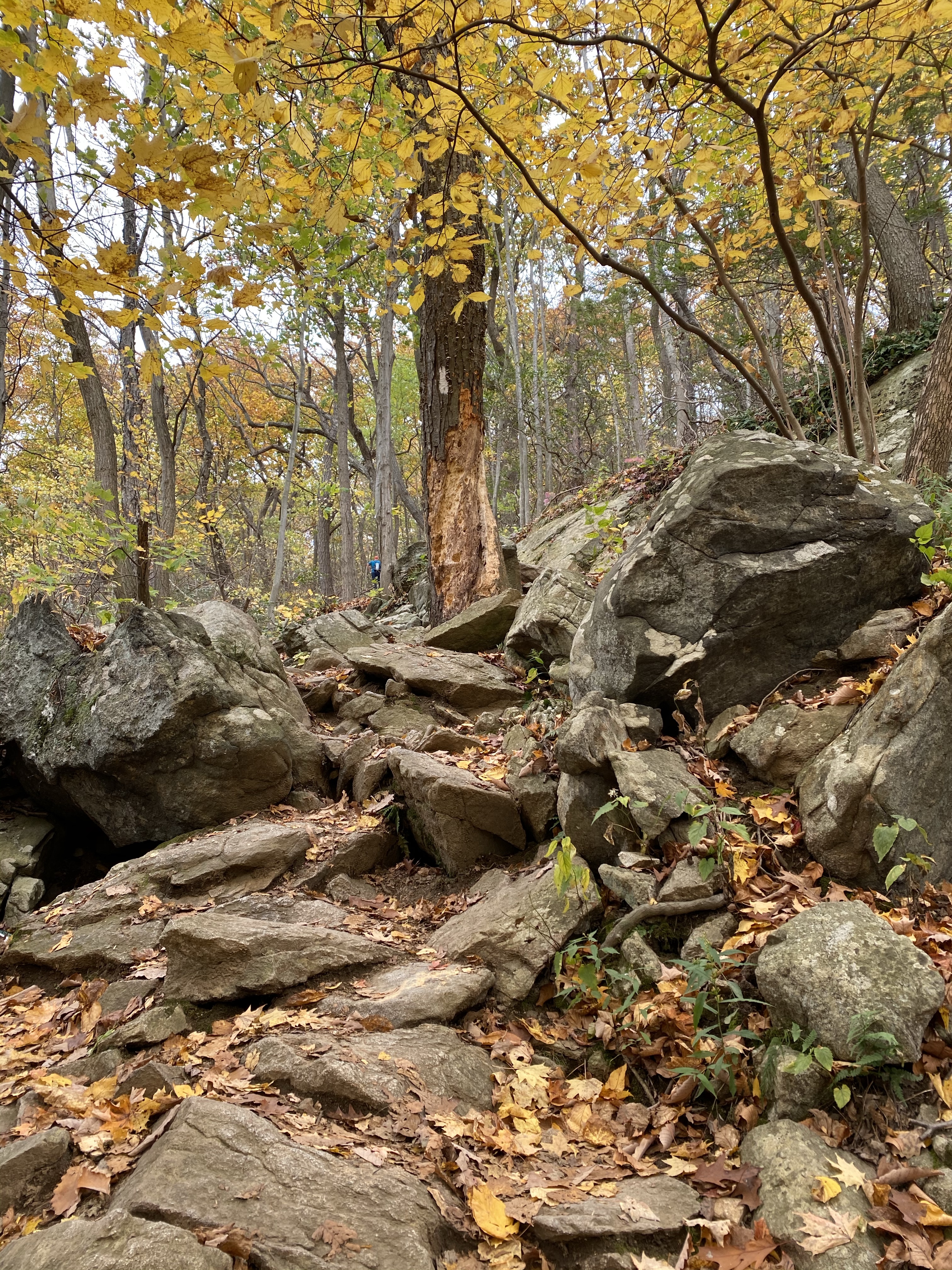
On the way back I took a different trail that went up a bit of a short steep climb. It was all manageable and the variations of the hike was part of the allure.
As I took the trail to the return I continued to be mesmerized by the shadows.
I was fortunate to recognize a heart shaped rock in the light of an upcoming tunnel of trees which appeared to direct my return.
Be Present Gift of the Day
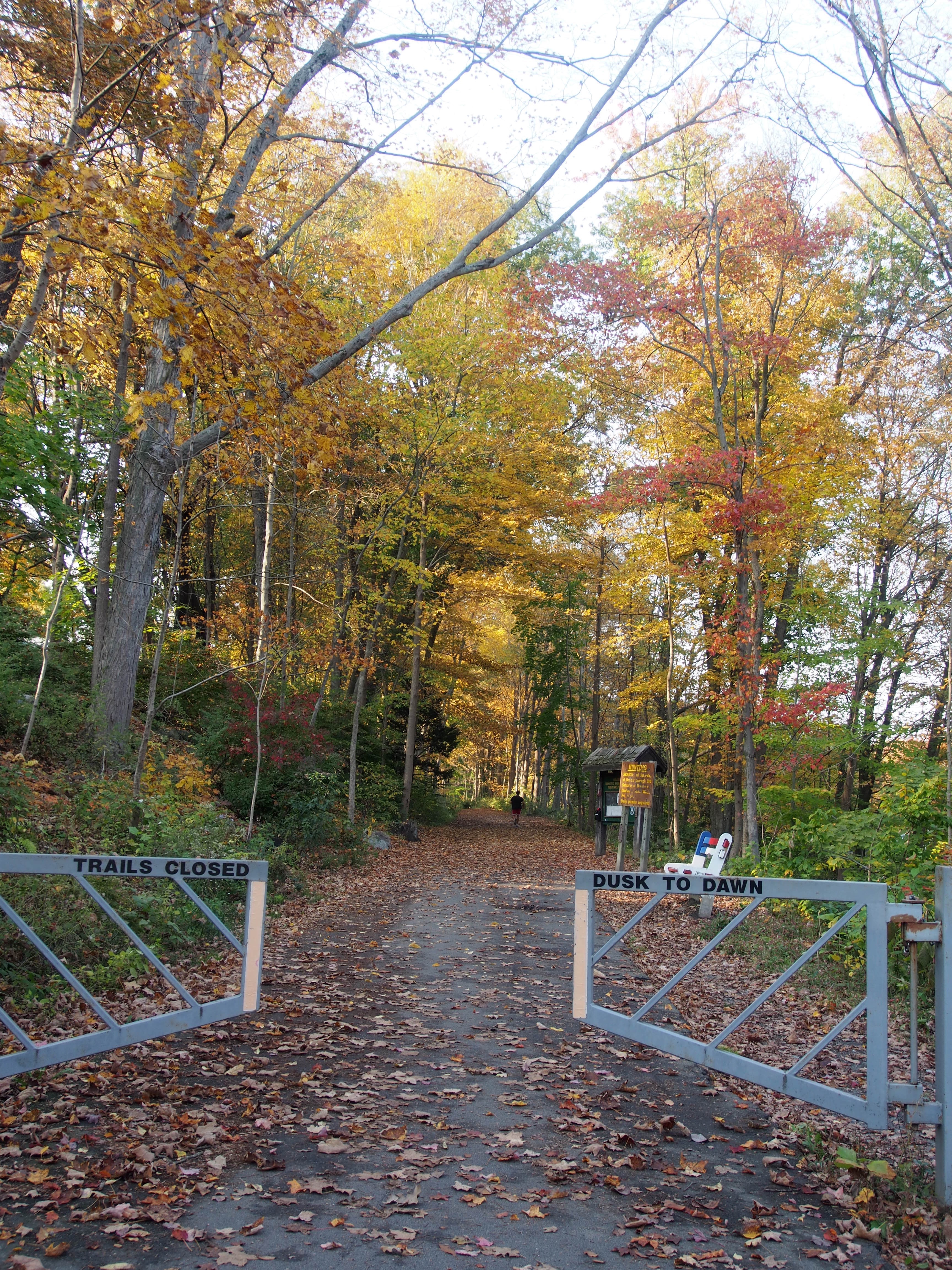
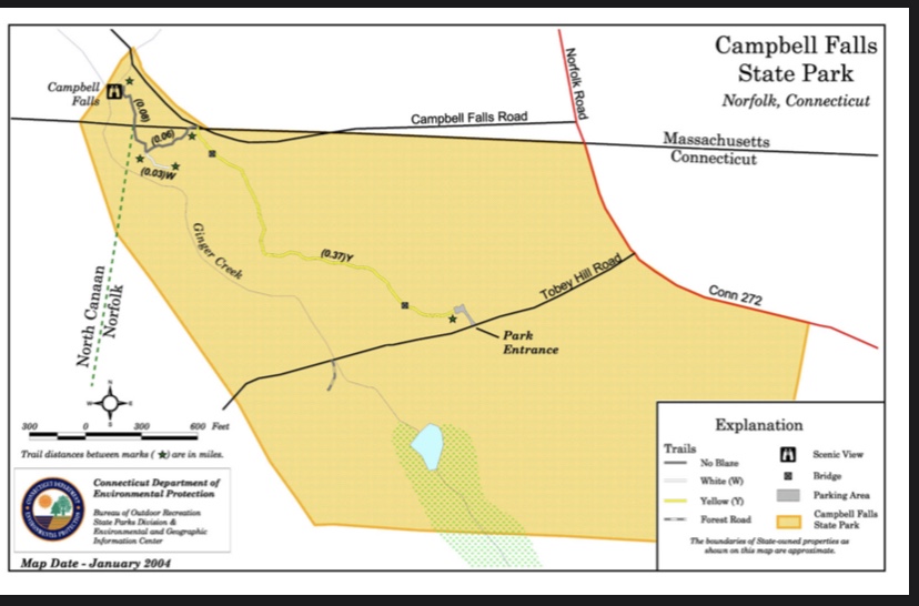
Overall the hike was so much fun and what most would consider short at 1.4 miles out and back to the Norfolk lot. On top of that there is Haystack Mountain near by which would provide you with a mountain overlook to take in the Fall views and Woodcreek bar and grill for a bite to eat.
A great day trip for sure! Another note is that this was named one of the 10 best New England waterfalls in some reference articles. Below is the link to the CT website to Campbell Falls State Park. You can park on the CT or MA side with MA side being closer to the falls.